
Introduction
While doing research trying to find the old route that US25E took over the Cumberland Gap, I found a link to http://www.us-highways.com/cgap00.htm by Robert Droz that no longer existed. I found a copy of it in the internet archive and found it interesting enough that I wanted to preserve it for others to see. I posted a few ‘UPDATES’ in the photos.
Below is a map with a blue line added to show the original path of US25E and an orange line showing the path of US58. The intersection of US25E and US58 is now the parking lot of the Daniel Boone Visitor Center.
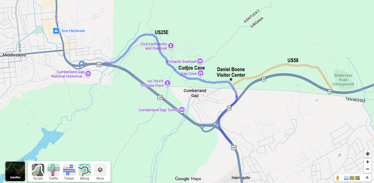
Old US 25E : Crossing the Cumberland Gap
Following this page are 33 images taken along the recently removed old asphalt route of US 25E up and over Cumberland Gap. To see them now and pass on a history lesson of the Gap, see ‘Photos of The Gap’ below.
The Cumberland Gap has been in use for foot traffic since before Europeans colonized America. The earliest records of American use of the gap occur in 1769, when Daniel Boone explored the area. In 1775 he blazed a trail known as “Boone’s Path” or Boone’s Road”. By 1779, Daniel Boone’s blazed trail would be a primary route used by settlers moving into Kentucky and Tennessee. By 1796 the name “Wilderness Road” had came into common usage.
During the War Between the States, the strategic gateway was first occupied by Confederate General Zollicoffer on Nov 13, 1861. He retreated when a superior force under Union General Morgan approached. General Morgan fortified the Gap but he, too, was forced to retreat when Confederate General Bragg brought a superior force to the Gap in 1862. In 1863, Union Generals Shekelford and DeCourcy approached the gap from North and South in superior numbers, forcing the surrender of Confederate General Frazier, 2000 men, 18 guns, and a large supply of ammunitions. The Gap did not change hands again. During the war, King Solomon’s Cave / Cudjo’s Cave was mined for saltpeter for gunpowder and used for shelter, adding “Soldier’s Cave” to its monikers.
The railroads bypassed the difficult terrain of the Gap after the States War. The arrival of the automobile rekindled interest in the Gap as transportation corridor. The US government built a macadamized road connecting Middlesboro, KY to Cumberland Gap, TN in 1908, adding the names “Government Pike” and “Object Lesson” to the names used along the route. The new road passed by Soldier’s Cave, which started to become an attraction. In 1916, Virginia, Kentucky and Tennessee built macadamized roads connecting with the Government Pike, and the Pike was added to the “Dixie Highway” system. The 1921 Automobile Blue Book mentions a monument along the route showing where Virginia, Kentucky, and Tennessee meet.
In 1925, the Gap was included in the planning of US highways, on US 411’s planned route from Bristol, VA to Corbin, KY. The Tennessee approach was not included, as it had been in the Dixie Highway. US 25 had been assigned to much of the Dixie Highway, and Jellico was the initial beneficiary of the US 25 routing. By 1926, US 25 was split with a eastern leg passing through Cumberland Gap. US 411 truncated in Virginia. US 411 was replaced by US 58 in 1934.
The name “Cudjo’s Cave” came from a book with the same name by J. T. Trowbridge that was published in 1863. In it, a slave from East Tennessee named Cudjo escapes and hides in ‘Cumberland Grotto’ while making his way to Kentucky and the north. The description and locale of the grotto in the story were similar to the Cave. In 1920, Lincoln Memorial University bought the Gap, Cavern, and lots of surrounding land from private sources. The college leased the Cave to private interests who hoped to capitalize on the notoriety the Trowbridge book brought. The Cave was electrified in 1934. The advertisement is from 1940, with ‘Very Reasonable Rates’. The stream in the cave supplied water and power for Lincoln Memorial University in Cumberland Gap, TN, in the valley below, and still provides water for LMU today. Cumberland Gap Mountain Spring Water is bottled from this source. The actual cave itself was leased by Lincoln Memorial University (LMU) to various operators over the years until it was donated to the National Park Service. Tours are once again held here, I have heard they plan to use lanterns in future tours as opposed to the old electric illumination.
In the 1990’s, the Cumberland Gap Tunnel was built to replace the route over the gap. This allowed for four-laning of the highway, which would have been difficult up the historically sensitive lands in Cumberland Gap National Park. The new tunnel was opened in 1996, and the old road was closed except for a short section still in use by the National Park Service.
In 1998, I climbed the gap and took 33 pictures. See below.
In 2002, the asphalt was removed from the old Wilderness Road in an attempt to restore it to the look of Daniel Boone’s day.
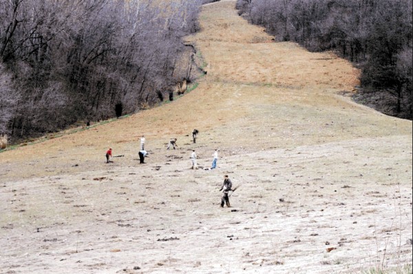
From Bill Porter: The National Park Service opened up the trail through Cumberland Gap on May 27, 2002. If you didn’t know that US-25E used to be there you never would be able to tell. This is a photo I took in March (2002). The people are LMU students who planted 20,000 trees during their spring break (in 5 days, actually) along the entire old 25E roadbed and a couple of other places. This was taken from the current highway just north of the bridge across the road to the Pinnacle. (about the place in the road in the upper left of picture #33) and looks up the old road toward the Sugar Run turnoff. Basically this is the same area you have in pictures 30, 31, 32 and 33, just from a different viewpoint. You can see where they filled in the roadbed.
Photos of The Gap
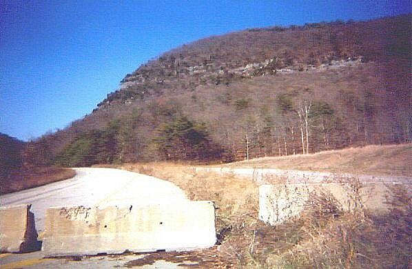
Looking up old US 25E from its Tennessee terminus. At least I think I was in Tennessee, give or take a few feet. Temporary barrier walls have been placed from shoulder to shoulder to keep out vehicular traffic. The overgrown median has curbing in this area.
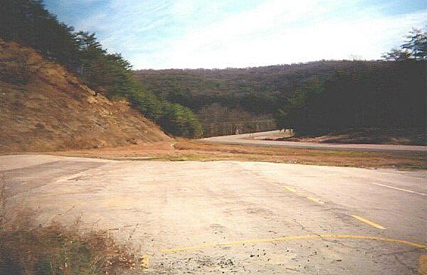
Looking back down into Tennessee and Virginia, the end of the pavement. This was where US 58 used to intersect old US 25E. There is no sign on the left of where US 58 used to be, the mountain has been restored. The curving road in the background is no longer US 25E, but it does allow access to Cumberland Gap, TN. I parked my truck in this gore area for my hike into the unknown (At least for me).
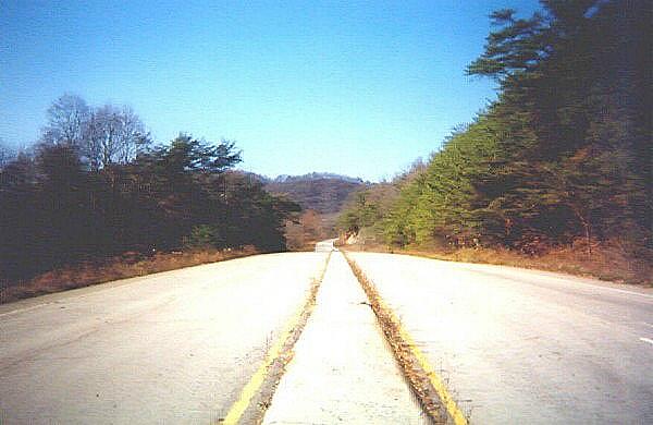
Hiking north, this is where old US 25E became a two lane road. At this point, there was not much climbing. I wondered what the gap would look like.
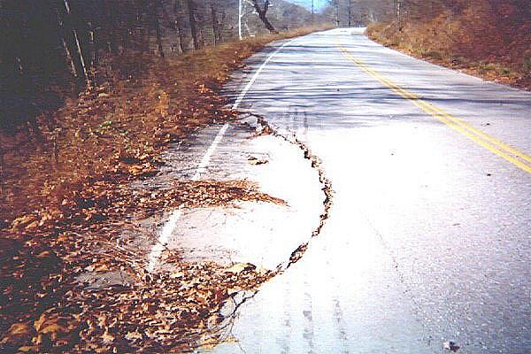
A little ways up the Gap, pavement is already starting to fail. Reportedly, this sort of pavement failure has been a problem for a long time. According to Mr. Porter, this spot was particularly troublesome, requiring frequent maintenance. The US park service is planning to have the old pavement removed, if it doesn’t slide into Cumberland Gap, Tennessee, first. I think the roadbed will be restored to the “wagon-train” days, at the dawn of the 19th century.
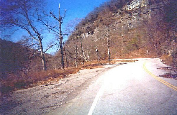
I decided to stop at this odd wide spot on the side beside the road. You can see an electric pole with a small transformer in the center of the picture. Later on I was told that there used to be a store here that sold cheap cigarettes and tours of Cudjo’s / Soldier’s / King Solomon’s Cave. I did not know the cave’s name then, I had to look on old maps for it. This used to be a roadside attraction, the park service has re-opened the cave for tours. Another attraction was the low taxes on cigarettes, Virginia being a tobacco state. Supposedly there is a spot of Virginia down beside Cumberland Cap, TN that has a gas station on it carrying on this cheap smokes tradition.
Back to my hike: I figured that there had to be a way to get close to the Gap than hiking the whole way. It was time to take a few pictures and head back to my truck.
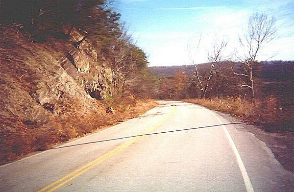
I turned and took a look back down the old highway. This had been quite a hike, especially considering my Florida-acclimated legs are used to less steeper grades.
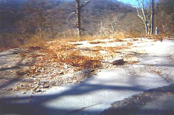
Since I did not know if I would make it back, I took more pictures of what seemed to me to be a very strange place. This is the foundation of the log cabin style store and the parking area across the road from Cudjo’s Cave. Down in the valley below is Cumberland Gap, TN. There was not much room to park here, maybe a half dozen cars at most? I can only imagine how much fun it would have been to back out of this parking area into the truck traffic that most certainly used US 25E. Re-supplying the store should have been an interesting and somewhat dangerous operation.
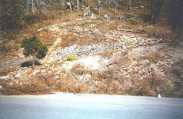
This is a zig-zag path further up Cumberland Mountain just to the southeast of Cudjo’s Cave. The tour of the cave ended somewhere up this trail, at the original “Solider’s Cave”. Also, there are some States (Civil) War era entrenchments there, but you have to have a good set of eyes to pick them out, so I am told. Way further past that is the parking area at Pinnacle Peak, the easier way to get to the caves these days, I guess. I don’t know if the Park service is going to restore this path, but they probably will. That wooden fence has seen better days.
UPDATE: The National Park Service did in fact preserve this path and is now a concrete walkway.
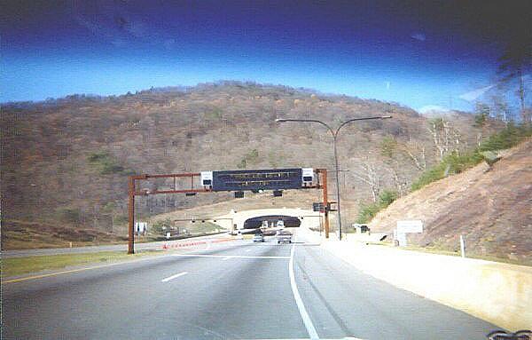
So, I hiked back down to my truck, got back on US 25E (Missed my chance at a picture of the end of US 58) and went through the famous Cumberland Gap Tunnel. Kentucky and Tennessee are very proud of their ends of the tunnel; it makes for a grand exit on either side. There are also signs reminding you not to bring anything into the tunnel that might blow up. There are massive fans inside the tunnels, keeping circulation going. The tunnel is also not terribly long, daylight on the far side was quick to appear. Once through the tunnel I went to the main entrance of Cumberland Gap National Park on the west side of the road. I had just come from the east side, so that was not encouraging.
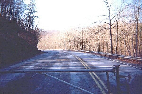
I went to the main vistor center of Cumberland National Park, hoping for a map that showed Old US 25E. The newer brochures showed it gone, not even a trail to mark it. A very helpful lady behind the desk had a copy of the old map that showed US 25E up the gap. Aha! She made me a copy, and I knew where to go. Up Pinnacle Road to the small part of the road that was still in service. Off I drove, crossing over new US 25E. The old section is now part of Sugar Run Road leads off to Sugar Run and KY 988. There were gore areas here, just like at the Tennessee end, allowing a good amount of parking on the old highway if you are not too choosy. I parked on the high end, towards what I hoped would be the Gap. I went down to the Kentucky (north) end and took a picture down into the closed portion heading towards Middlesboro, making sure I had the right place. The guardrail was in good shape.
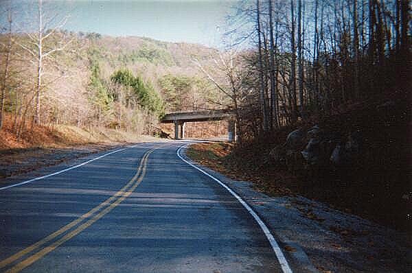
This is looking south along the short portion of old US 25E that remains in service as Sugar Run Road. Off to the left, out of the picture, is the road to Sugar Run. The overpass is Pinnacle Road, heading up to the old forts and a parking area. The old 1921 tour book mentions a road leading up to the summit. My best guess has it where the overpass is today. Going from US 25E straight up the mountain would have been quite an exciting drive. According to Mr. Porter, just above the intersection of Sugar Run Road with Old 25-E (Just off the left side of the picture) is an old pull-off that used to be an overlook. The stone wall is still there and can be seen if you’re coming up to 25-E from the Sugar Run area. It’s up the hillside to your left right before the road curves to meet 25-E. The road leading up to the summit (Skyline Drive) for the most part is still used today. Before the park, you would go to the gap and turn there up the mountain. If you look carefully, you can still see the roadbed going up from the gap. You had to pay to go up the road to the Pinnacle and there was a gift shop there as well.
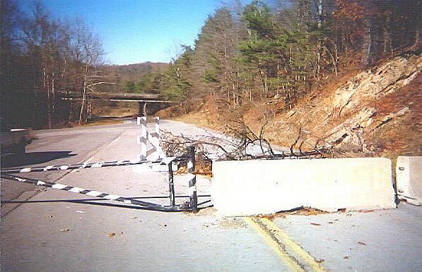
Looking north (Kentuckyward) from the southernmost closed section of US 25E, down the section that is remaining in service. The bridge is the same as in the previous picture, Pinnacle Road, leading up to the peak. On the left is my truck. Behind that on the left is the connection to Pinnacle Road. The signs along Pinnacle point this road out as Sugar Run Road.
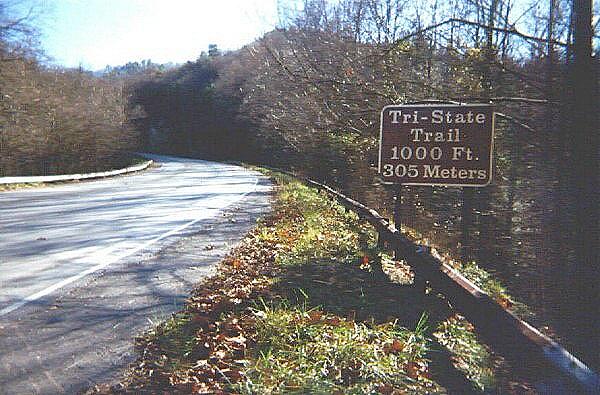
I hiked up the south end. There was some construction debris near where I parked, I hope that is gone now. Up the Gap I went, the hike here was far steeper than at the Tennessee end. A little way up I found my first gem. This old sign is backed in wood. I can understand that reaching a nice round figure like 1000 feet is something, but the metric equivalent seems silly. Not all the signs along the road are gone, but only the brown park service ones remain. This sign is starting to fall apart; the lower left corner is splintering. The guardrails are rusty, bent in places, missing in others.
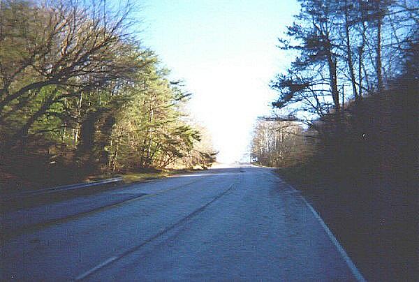
Further up the Gap. You can barely make out a sign on the right side of the road ahead. This section looks like it was an old passing area, two lanes southbound and only one northbound. Accoring to Bill Porter, cars would zip along the passing lane at 60 MPH, trying to get around slower moving trucks. About now I was wondering if we would run out of up.
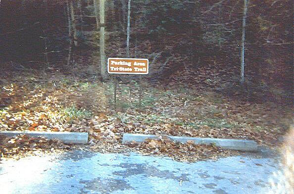
A parking area, still signed even without any vehicular traffic. This is just north of the Gap in Kentucky. Micheal Vaughn sent me more information: The old Tri-State Trail footpath leads up to the Tri-State marker. This can be found under a simple roof shelter and marks the point at which Kentucky, Tennessee and Virginia come together. The Tri-State Trail will be the northern terminus of the Cumberland Trail, now being constructed. See Home – Cumberland Trail Conservancy for more information. The TST parking area was the site of a mid-40’s roadhouse of some degree of ill-repute. Several deadly gunfights broke out among the patrons of this establishment.
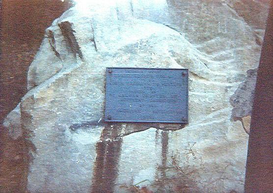
To the immediate north of the parking area on “Indian Rock” is this trail marker, denoting this as on the Daniel Boone Trail from North Carolina to Kentucky 1775?. This stretch of travelled path had an awful lot of names. The marker was placed by the St. Agatha chapter of the Kentucky Daughters of the American Revolution in 1915.
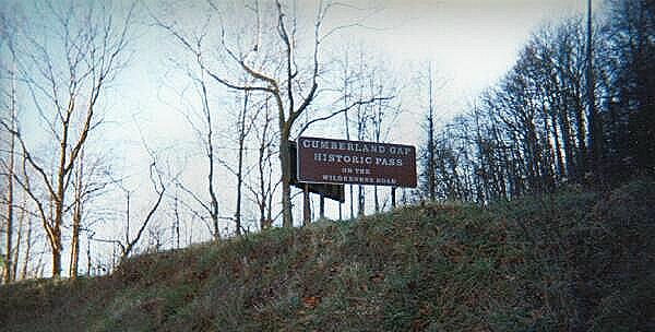
Ah, that sign from earlier. “Cumberland Gap Historic Pass on the Wilderness Road.” The sign on the other side said the same thing.
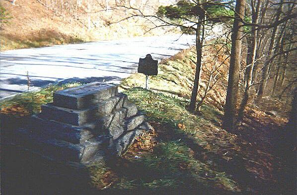
Just to the south of the parking area are the remains of an old monument. Maybe this was the old tri-state marker? One was mentioned as being along the road in the 1921 Automobile Blue Book. In the background is a roadside monument placed by the Kentucky Department of Transportation. Bill Porter added: “Believe it or not that monument in the picture (minus the statue on top that is missing in the photo) used to be a monument to a dog. I don’t know the story, but the statue was of a dog. There were several other monuments in the gap. They are now all gone (even the one in the picture and the historical marker as well) as of early May 2001.”
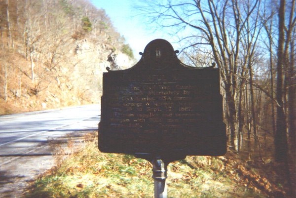
“A Masterful Retreat” – Historical Marker placed by KyDOT. This is a monument to the 1862 Morgan retreat I mentioned earlier. This marker is now gone. Perhaps it is planned to be part of an exhibit in the park. Bill Porter added: Morgan blew up his ammunition as he evacuated the Gap and the crater is visible about a quarter mile up the Tri-state Trail from the Gap.
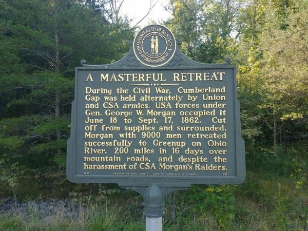
UPDATE: This sign was relocated nearby to the Thomas Walker Parking Area on Pinnacle View Road within the Cumberland Gap National Historical Park (36° 36.545′ N, 83° 40.658′ W.)
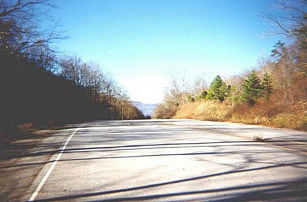
Looking south (Tennesseeward) at the crest of the Gap on old US 25E. It’s all downhill from here.
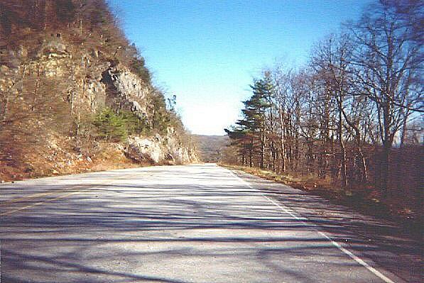
South towards Tennessee, and to Cudjo’s Cave. I can only guess that Virginia DOT did not believe as strongly in guardrails as Kentucky DOT did. According to Bill Porter, there were guardrails in the Virginia section of 25-E but not all the way up. They didn’t work well anyway. More often than not they just made the wreckage worse.
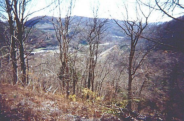
Looking down on Cumberland Gap, Tennessee from old US 25E. I figured it would not be long now before I got to where I had been before.
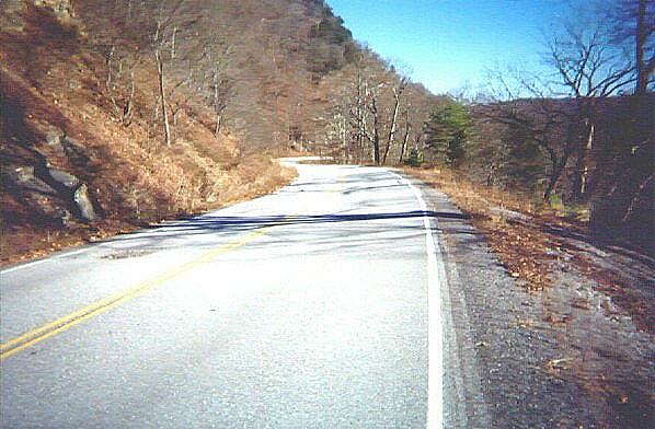
Hiking down old US 25E, this curving section of asphalt looked familiar somehow.
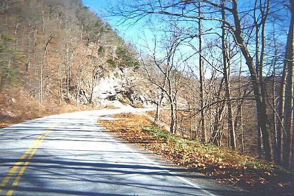
Cudjo’s Cave ahead.
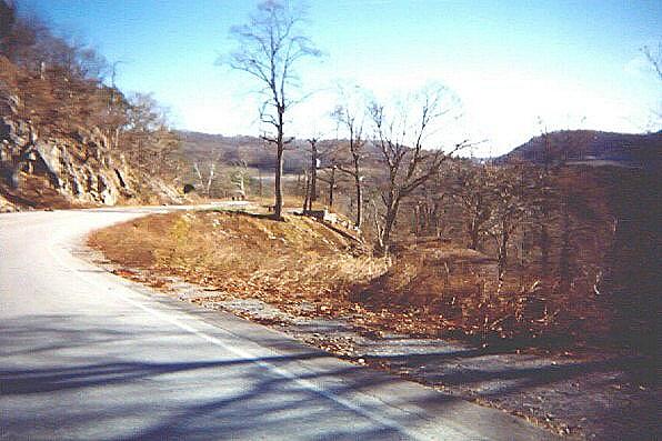
The cave, the foundation of the old store, and a water tower structure for Cumberland Gap, TN, or at least one that provided water and power for the previous owners of King Solomon’s Cave / Soldier’s Cave / Cudjo’s Cave – Lincoln Memorial University. Yes, an active stream runs inside the cave, and was harnessed for drinking water and hydroelectric power. I assume the old lighting in the cave was powered by that structure. The spring inside still provides water for LMU. According to Mr. Vaughn, Johnny Greene of Harrowgate, TN was the last leaser / proprietor of the shop and Cave before the National Park takeover. According to Bill Porter, LMU owned much of the lands that became Cumberland Gap National Park (virtually all the park land in Tennessee and a sizeable chunk around the Gap area in Virginia, and donated it for the Park. LMU retained the rights to the Cave and the water for a certain length of time. They voluntarily gave up the Cave when the time expired and the National Park Service agreed to let them continue to use the water. I don’t know if the college or the Park Service is bottling the spring water for sale.
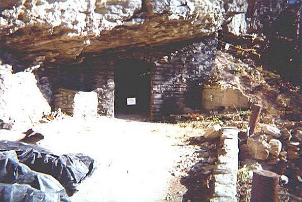
Cudjo (Soldier’s / King Solomon’s) Cave, closed by a rock slide on your right. The little piece of paper on the chain says the structure is unsafe. The yellow tape on the right has a similar message as it drapes over the loose rocks. You can see sunlight inside the cave from the gap in the rocks on the right. There used to be benches here for people to wait for the tour guide to take them into the cave. To the left of the cave entrance is a place that held a sign showing the hours and tour prices.
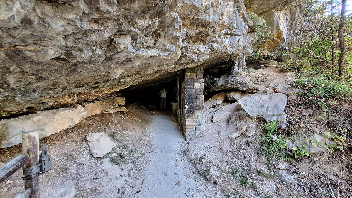
UPDATE: This is what the lower cave entrance looks like in 2026.
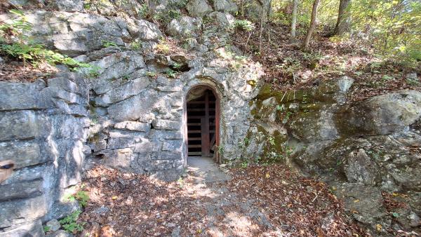
UPDATE: This is what the upper cave entrance looks like in 2026.
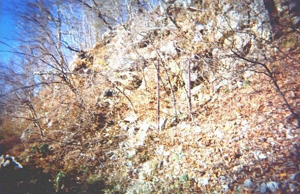
Hiking back northward, up and over the Gap to my truck, I found an unsigned sign. According to Bill Porter, these two bare poles were the location of a “Welcome to Kentucky” sign. Goodbye, cheap smokes?
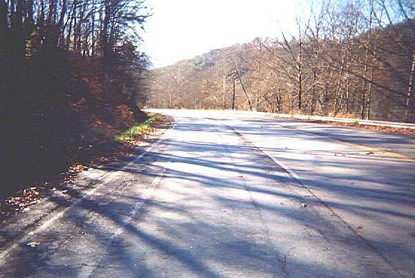
I went to my truck, drove it north a few hundred feet, parked it in the northern gore area, drank a Diet Coke, then started walking down into Kentucky. There is guardrail here, even though the dropoff was more drastic on old US 25E passing by Cumberland Gap, TN. The center lane looked like a turn lane leading to Sugar Run to me, but Bill Porter assures me it was another passing lane. Tragically, I am not the only one who made that assumption. Bill informed me that there were quite a few wrecks at that point because it was a blind curve and you could come up on someone waiting to turn off onto Sugar Run road with little warning. “I remember a bad wreck there a few months before the tunnel opened that closed the highway for 12 hours and killed several people. They got sandwiched between a wreck in front of them at the turnoff and an 18-wheeler that hit them from behind. It killed everyone in the car.”
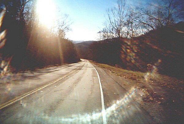
Down into Kentucky, I make the discovery that taking pictures into the sun was not a good idea. Actually I found this out when I developed the film. It is an attractive effect, so my mother thinks. Then again, she is my mother. This stretch of road was pretty flat, much like my starting hike on the other side.
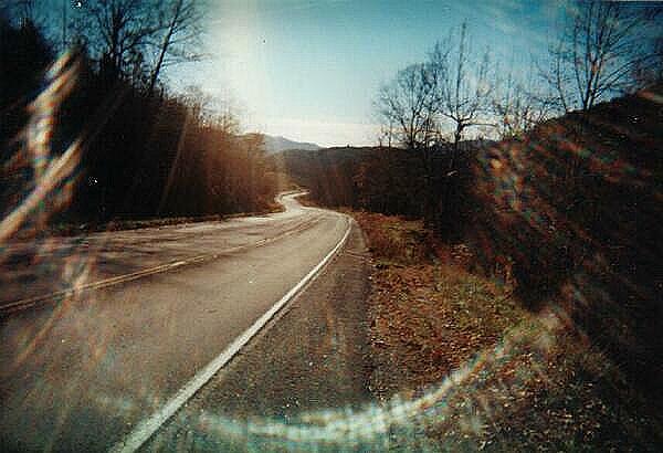
Above you on the left is Pinnacle Road, leading up to the peak of Cumberland Mountain. From that road, you can look down and see old US 25E. You can make out a light or telephone pole along that road in this picture.
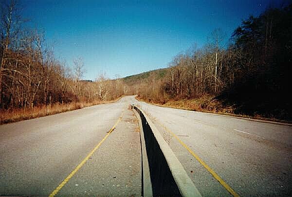
Finally at the bottom, I turned and took a look back up US 25E. It’s hard to tell in this photograph, but there is a ramplike lane that was used for the temporary connection from US 25E to this road on the far right of this picture. The fill dirt is still in place for the lane, even though the asphalt has been removed from most of it.
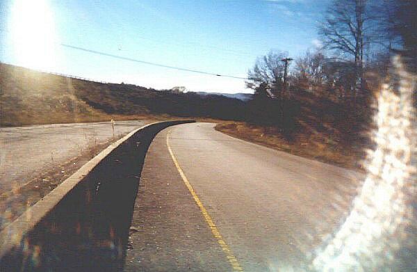
New US 25E is above you and to the left, heading into the Kentucky side of the Cumberland Tunnel. The concrete Jersey Barrier in the middle dates from the time new construction, it was used to reduce accidents along this segment of old US 25E. Bill Porter added, “I remember when that barrier wasn’t there. It was just a wide spot in the pavement between the northbound and southbound lanes. The road was four laned at that point but they put the barrier in and made it two laned because of the tunnel construction.”
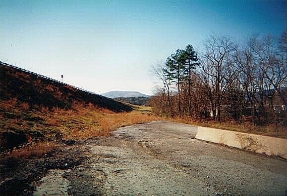
The northern terminus of old US 25E, and the end of this photo essay. You can tell where the pavement was in 1996, just before the tunnel was opened. Off to the right is the outskirts of Middlesboro.
About The Author

Jim Oaks is the founder of TheRangerStation.com, the longest-running Ford Ranger resource online since 1999. With over 25 years of hands-on experience building and modifying Ford Rangers — including magazine-featured builds like Project Transformer — Jim has become one of the most trusted authorities in the Ford Ranger off-road and enthusiast space.
Since launching TheRangerStation.com, Jim has documented thousands of real-world Ranger builds, technical repairs, drivetrain swaps, suspension modifications, and off-road adventures contributed by owners worldwide. TheRangerStation.com has been referenced in print, video and online by enthusiasts, mechanics, and off-road builders looking for practical, and experience-based information.