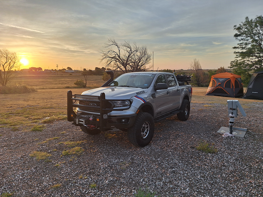
It was late when we arrived at the campground in Dalhart, Texas. It took a few minutes to figure out where the camping area was, and a little additional time to get the tents set up due to a light wind, but we finally got to relax and talk outside for a while and enjoyed a light breeze before turning in for a good night’s sleep.
On day three we woke to a beautiful morning and made breakfast before packing up to continue our adventure.
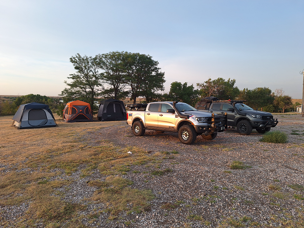
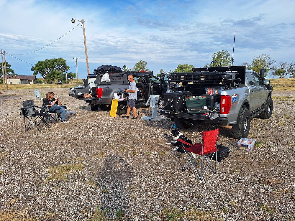
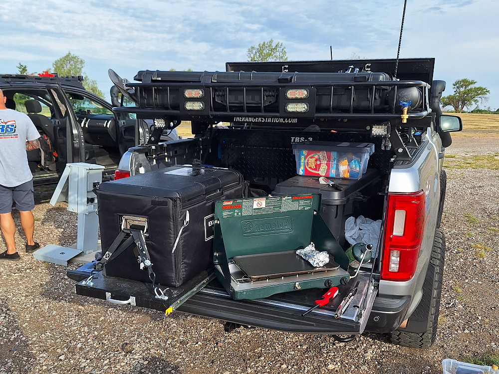
At some point in this adventure, you’re probably going to wonder why some of us have roof top tents, and some of us do not. For me personally, it’s an issue of price, weight, and the amount of space taken. I use a Caddis Rapid Tent 4 which costs $240, is 6-feet tall in the center so I can stand up, will sleep four people, weighs 24-pounds, and is only 44.75″L x 8.75″W x 8.75″H when closed. I can easily carry it in the bed of the Ranger or on the rack over my bed. The cheapest roof top tent available at the time of this writing is the X-Bull Roof Top Tent which is $700, weighs 119 pounds, has 51-inches of headroom, and is 55″L x 47.12″W x 10.24″H when closed. A rooftop tent can take away bed space if mounted low, create a drag and effects MPG’s if mounted above the cab, and adds 100 additional pounds of weight to the vehicle over a ground tent.
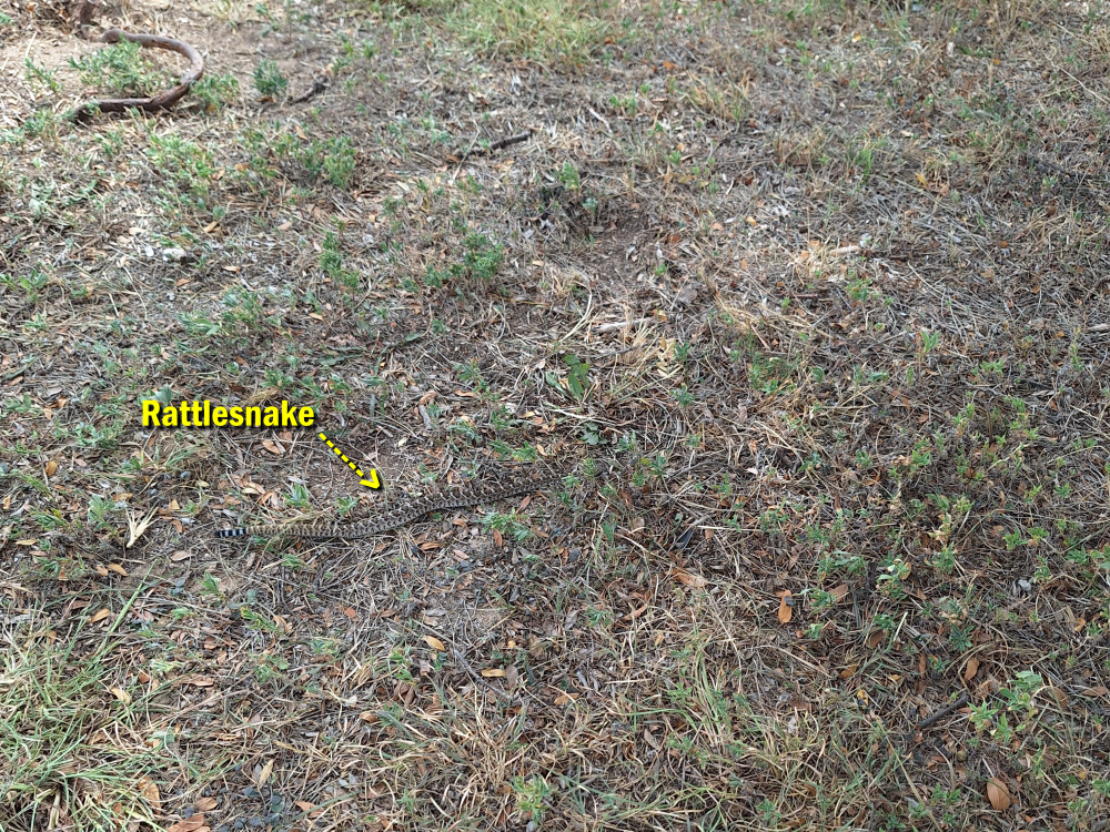
I try to make it a point to look over the area and make sure I didn’t forget anything before I leave. While looking around I spotted a rattlesnake right where one of our tents had been setup. I don’t know how we didn’t see it when we were walking around putting our stuff away, but it’s a good thing we didn’t step on it or reach down for something next to it. For the sake of this experience, I’m going to share some rattlesnake information below.
When Rattlesnakes Are Most Active
Rattlesnakes are cold-blooded reptiles whose activity levels depend heavily on temperature. They are most active in spring through early fall, particularly at dawn and dusk when conditions are cooler. In the heat of midday, they often shelter under rocks, logs, or shaded vegetation. In cooler months, they slow down significantly or hibernate in dens.
How Rattlesnakes Behave
Despite their intimidating reputation, rattlesnakes are not aggressive by nature. They prefer to avoid humans and often remain still, relying on their camouflage to stay hidden. The rattle is a defensive warning, not a sign of aggression—it’s their way of saying, “Stay back.” Most bites occur when a snake is surprised, stepped on, or handled.
How to Avoid Being Bitten
- Stay alert: Watch where you walk, sit, or place your hands, especially in rocky or brushy areas.
- Wear protection: Hiking boots and long pants help reduce bite severity.
- Use light at night: Snakes may be active after dark, so use a flashlight.
- Keep distance: If you see or hear a rattlesnake, back away slowly. Never try to touch or kill it.
- Check campsites carefully: Look around before setting up camp and shake out gear before packing up.
- Check your shoes: A small rattlesnake could coil up in your shoe overnight.
What to Do if You’re Bitten
If a rattlesnake bite does occur, quick and calm action is critical:
- Call 911 immediately – antivenom treatment is only available in medical facilities.
- Stay calm and limit movement – rapid heart rate spreads venom faster.
- Keep the bite below heart level if possible.
- Remove rings, watches, or tight clothing near the bite area before swelling starts.
- Do NOT cut the wound, suck out venom, apply a tourniquet, or use ice—these outdated methods can make things worse.
For more information, please check out Venomous Snakes of Texas: Identification
Having escaped the rattlesnake encounter, we headed northwest on US87 to New Mexico on our way to Colorado. Along the way we decided to stop at the Capulin Volcano National Monument.
The Capulin Volcano National Monument is a well-preserved, relatively young (55,000 to 62,000 years old), symmetrical cinder cone. It rises steeply from the surrounding grassland plains to an elevation of 8,182 feet above sea level. The irregular rim of the crater is about a mile in circumference and the crater about 400 feet deep.
Capulin Volcano is one of the outstanding landmarks located in the northeast corner of New Mexico, where the rolling grasslands meet the foothills of the Sangre de Cristo Mountains. Capulin Volcano’s highest point provides unobstructed, panoramic views of the volcanic field, distant snow-capped mountains, and portions of five states (New Mexico, Oklahoma, Kansas, Texas and Colorado).
Capulin Volcano also offers visitors excellent opportunities for observing and understanding volcanic formation. The large volcanic field surrounding the monument contains at least 100 recognizable volcanoes, and aids visitors in gaining insights into 10 million years of the geological history of northern New Mexico.
They have a pretty nice visitor center here with a friendly and informative staff, but they charge $20 just to drive to the top of the volcano, so we decided to pass. We still have several days ahead of us, and we’ll be travelling to much higher elevations.
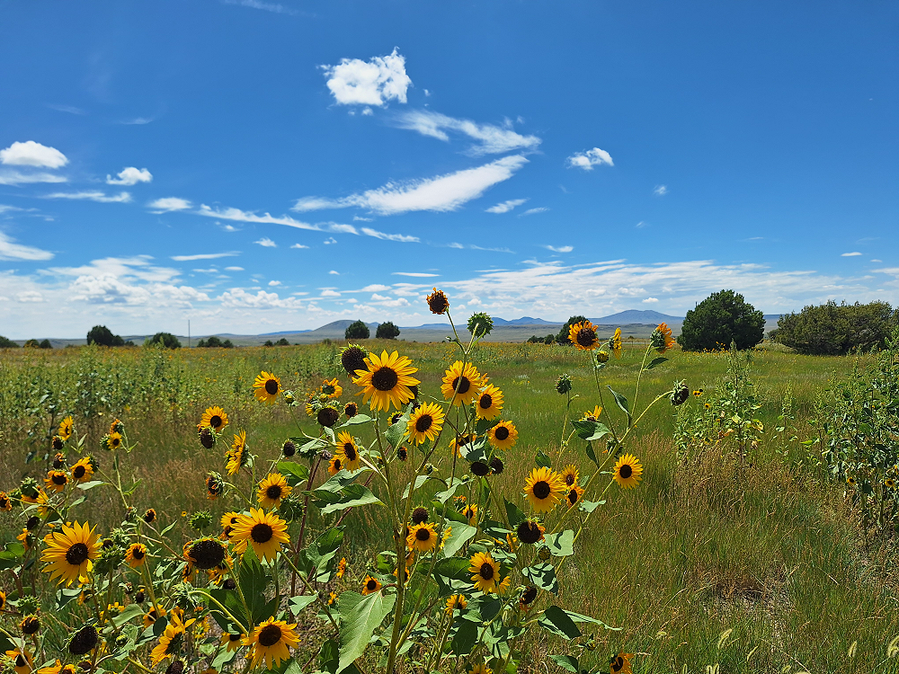
As we were leaving, we stopped to take a picture of the Capulin Volcano sign, and I couldn’t resist the urge to take a picture of the sunflowers. The fields around here were full of them.
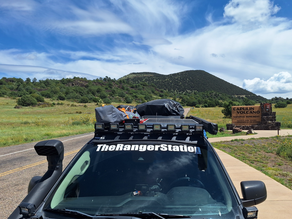
When we left the Capulin Volcano we headed north and made our way to Long Canyon Road (B036). Long Canyon Road is part of the Trans America Trail and is a rough two-track road that takes you past a few homes and leaves you wondering if you’re trespassing and going to have explain why you’re there.
The road bends and goes behind a house, and as you drive by, you hope the road continues and doesn’t end there. Continuing on you get a sense of relief and then it comes to another house. You cross a cattle grate with a house on the left and the road bends to the right towards a barn. You get a brief sinking feeling like this is it. The road ends here and these people are wondering what you’re doing on their property, but then you see the road open up again, and you continue pushing forward wanting to put that last residence in your rear-view mirror.
I had been through here in 2019, but for some reason none of it looked familiar to me, and I was hoping that I wasn’t leading Robbie and I into someplace we shouldn’t be, or somewhere that was going to lead to a confrontation. I kept looking at the GPS making sure that I didn’t miss a turn on roads that are barely identifiable. I joked on the radio and asked Robbie if he felt like we were lost, but I myself wasn’t 100% confident of where we were going.
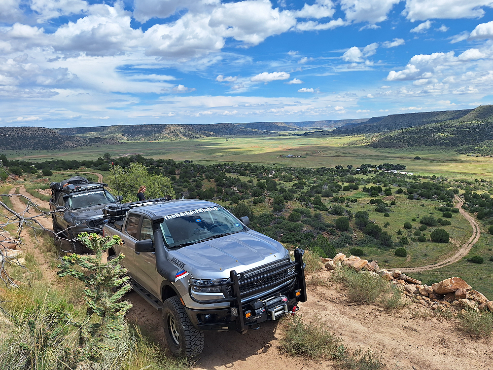
Shortly after that last house, the road forks and the path to the left doesn’t look like it would be the path to take, but it is. The farther you go, the worse it gets. But this area looks familiar to me. I remember this area. When travelling west on the Trans America Trail, this was the first point where it really becomes scenic. Where you really feel like you’re on an adventure. You start making your way up the narrow switch back, and as you do, the area you once felt like you were trespassing across turns into a beautiful view.
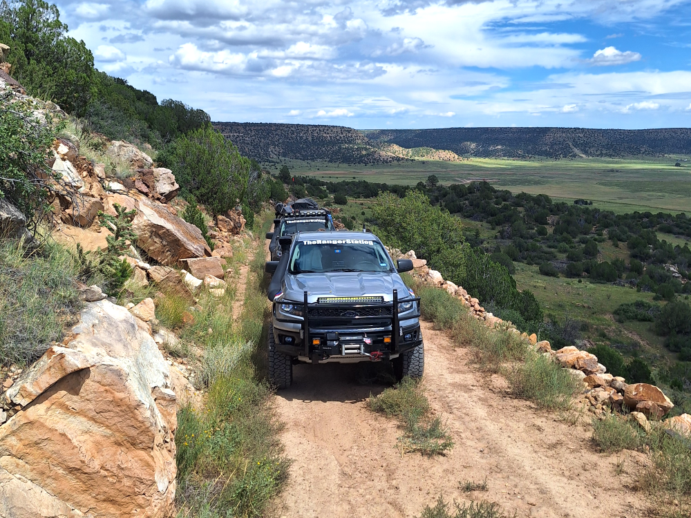
As neat and challenging as the road can be, especially if it’s muddy, it’s easy to forget that this is a county road. A vehicle could be coming down the hill, and there’s no place to pass. Someone will be forced to back up. And depending on how far up or down the hill you made it, that may not be as easy as it sounds. How far of a distance are we talking? About 3/4’s of a mile if you meet in the middle.
Once you get halfway up the hill you can’t help but stop and take a photo of the view.
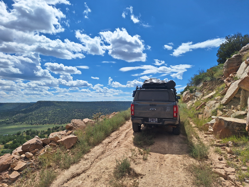
When you get to the top you may expect to go down a hill on the other side, but you don’t. The area levels out and another 1.5-miles later you find yourself in Colorado. There’s nothing there to let you know you crossed the border, and you wouldn’t know unless you were looking at the GPS. From here it’s just miles and miles of emptiness.
We stopped briefly to stretch and ended up with tiny bees in our trucks the size of house flies. They apparently really liked the sunflowers here. As we continued west, Robbie got to watch me weaving back and forth as I fought these little bees and drove at the same time.
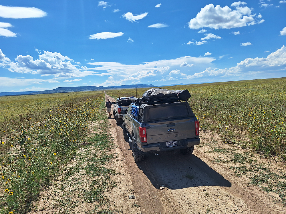
We continued west with no sign of civilization for 12-miles until we finally came to the small crossroads town of Branson, Colorado. There’s something about these wide-open spaces here that makes me wonder what it would have been like cross these vast areas by horse and wagon, or ox and wagon. Travelling west to stake a claim and start a new life. Who am I kidding. Those little annoying bees drove all the settlers away.
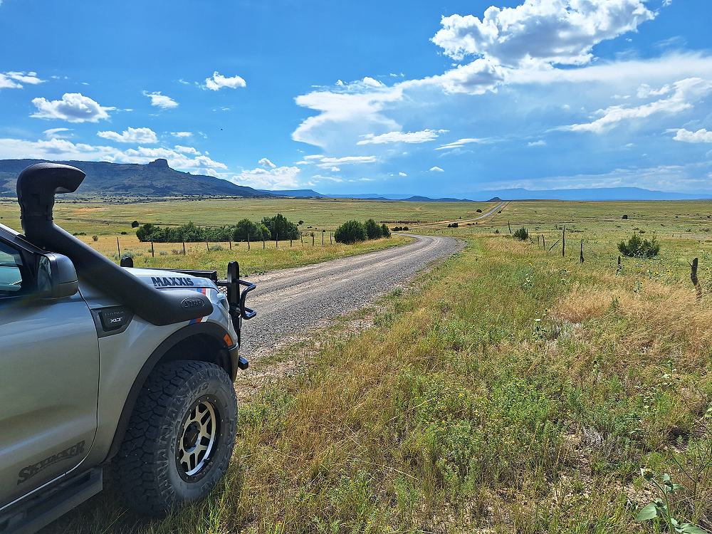
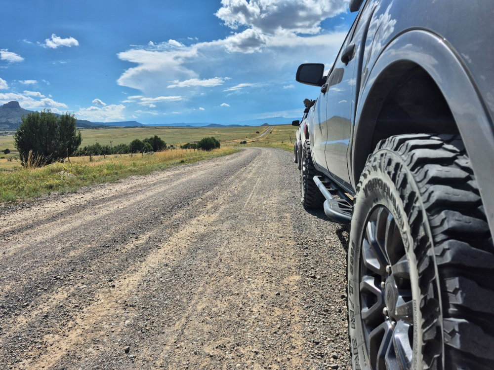
Another 40-miles and we finally arrived in Trinidad, Colorado. Trinidad sits along IS25 and is the biggest city in this part of Colorado. It’s a pretty city, but you get the feeling that all these people do here is smoke weed. There are dispensaries everywhere. We stopped at the Exxon gas station for fuel and there was an old RV parked off in a gravel lot that looked like it should have been a scene out of ‘Breaking Bad’. We saw a few vehicles come and go and they had a strong odor of pot as they passed by.
Another interesting thing about Trinidad is that the interstate is elevated and passes over it on bridges. There were public parking areas under the overpasses, and we stopped there in the shade to have a quick lunch before continuing on.
We were supposed to meet the rest of our group at the WE RV Champions Campground in La Veta on Sunday, so we still had a day before we needed to be there. When we left Trinidad, I plotted a route to the Apishapa Arch along the Cordova Pass and the Cordova Pass campground.
Among the most unusual features of the Spanish Peaks are the great dikes that radiate out from the mountains like the spokes of a wheel. These dikes were created as a result of volcanoes moving the rocks, and magma hardening in the cracks. They range from one to a hundred feet wide and can be up to fourteen miles long. Some are single dikes, while others are sets of parallel dikes.
Jose de Jesus Cordova owned a ranch near Aguilar, Colorado, and dreamed of a road that would conveniently connect his hometown to Cuchara Pass. Another main reason for wanting to build the road was to provide access for coal miners to commute between Aguilar and Weston. Cordova secured funding for the project, which the Civilian Conservation Corps helped to complete. Prior to 1934, the roadway was known as Apishapa Pass.
Apishapa Arch was carved through one of the volcanic dikes on the slopes of the Spanish Peaks along Cordova Pass. The stone tunnel sits at an elevation of 10,151 feet. It remains a prominent and historic Colorado landmark, plus makes for a great photo opportunity. It’s not every day that you get to drive right through the middle of igneous rock.
Getting out to take a photo, the cooler temp at this elevation reminded me that I forgot to bring a jacket or hoodie with me. In my defense, it was 100-degrees in Texas when I was loading up the truck, so the thought of needing a jacket was not at the front of my mind.
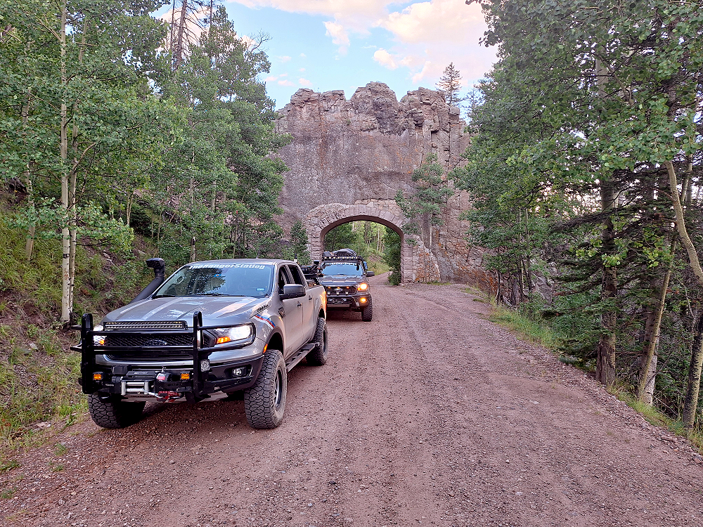
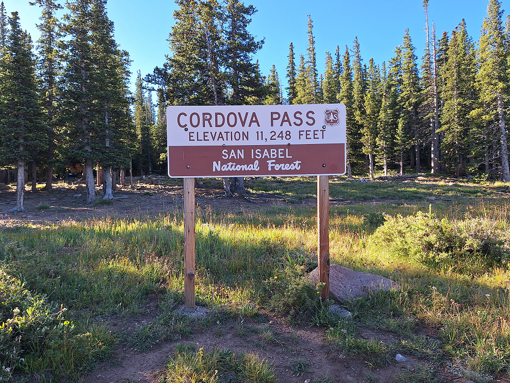
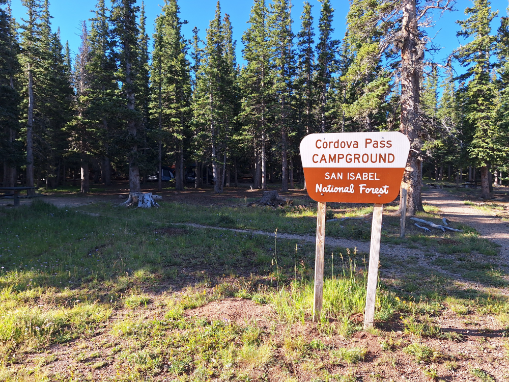
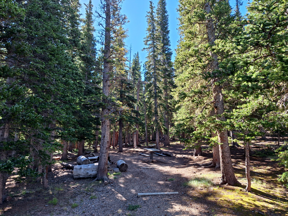
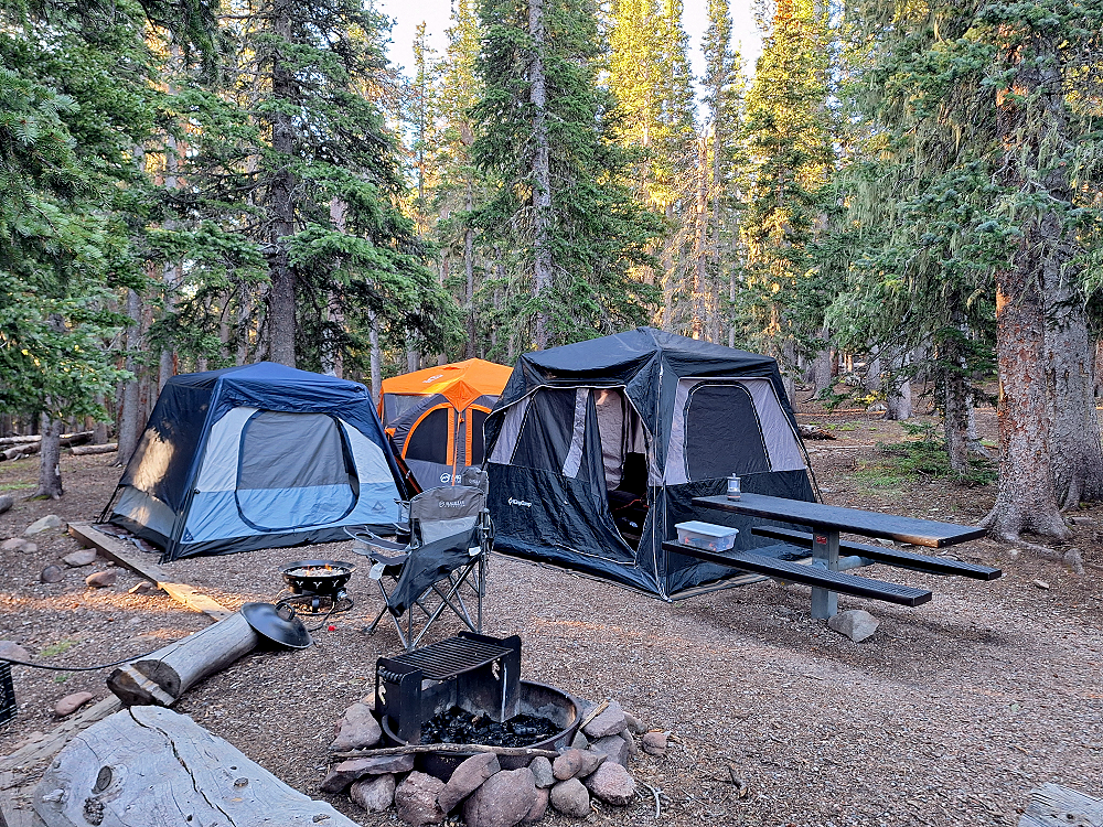
From the arch we continued over the pass to the summit and stopped for the night at the Cordova Pass Campground. The campground is 11,248 feet above sea level and is a beautiful area. There are only 3-campsites here, and we got the last one. The campsite was only $15.00 and there were envelopes and a pay station to deposit the payment. There was also a restroom with a vault toilet that was surprisingly clean. In fact, the next morning an older gentleman came and cleaned it while we were packing up to leave.
After making camp we made dinner, relaxed for a little while, and then retired to our tents for the night. I don’t have a zero-degree sleeping bag, but I have some body and hand warmers that you shake and they heat up. I opened one, threw it in my sleeping bag, and climbed inside. As soon as I was somewhat comfortable my Labrador Retriever ‘Marley’ climbed up on my sleeping bag and snuggled into me.
I had a hard time going to sleep and the wind had started to blow pretty hard. I laid in my sleeping bag feeling cold and having to pee. I didn’t want to get out of my sleeping bag because I didn’t want to be colder than I already was, but I finally had to accept the fact that I wasn’t going to make it through the night.
I walked to the edge of our campsite to relieve myself and watched as Marley walked off into the trees. I was trying to pee, watch him, and quietly call him while trying to not wake up the others all at the same time. In my mind I just knew that damn dog was going to find a bear to antagonize, but he didn’t. When we got back in the tent, I threw two more body warmers in my sleeping bag and climbed inside.
At one point I found myself in a fetal position with my knee laying on a body warmer. I thought to myself, how is it that I’m about to burn my knee and freeze all at the same time? I also discovered that a 55-pound dog can become 155-pounds when he doesn’t want to move.
Surviving the night, we got up to find that the wind had blown our neighbors tent down and they ended up sleeping in their hammocks. My night suddenly seemed better.
We ate some breakfast, packed up our gear, and continued on our journey.
Continuing down the Cordova Pass we came to the John B. Farley Wildflower Overlook Memorial which is dedicated to John B. Farley, who is known for his contributions to the preservation of wildflowers in Colorado. It’s a beautiful spot to stop and look at the Spanish Peaks. The Spanish Peaks are especially impressive in the spring and early summer when they still have snow caps.
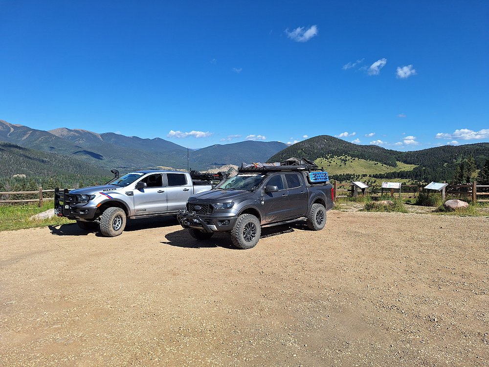
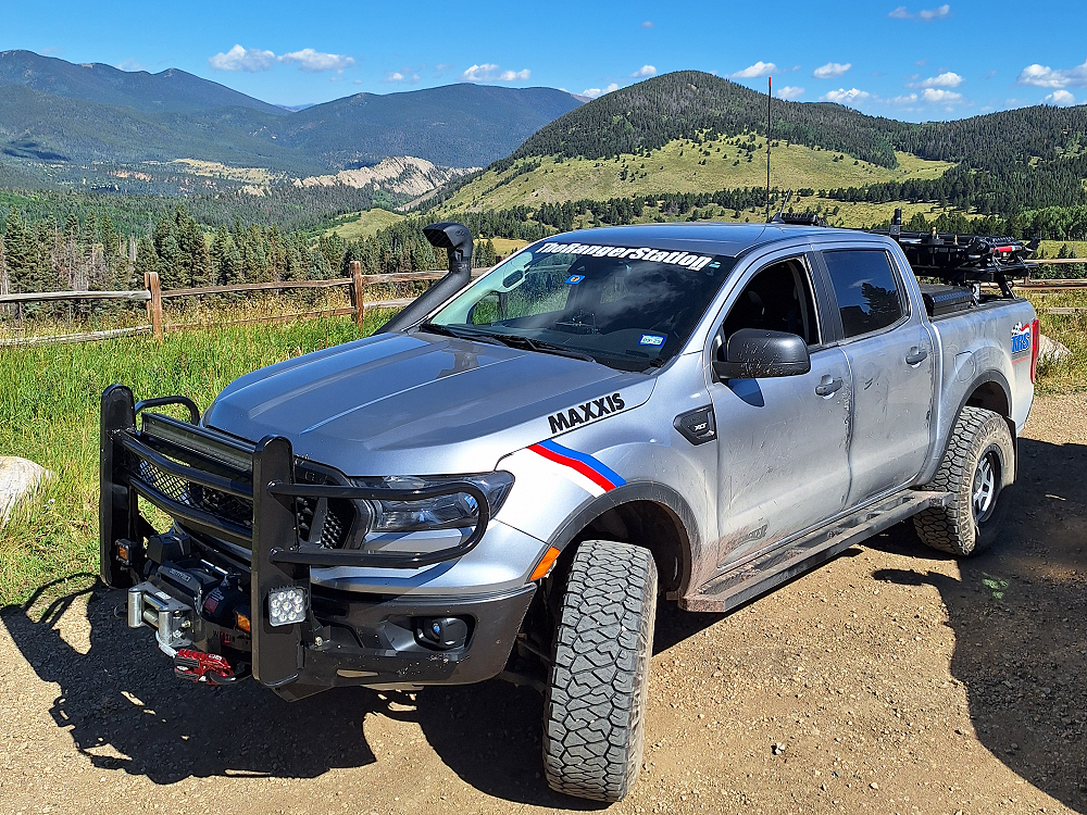
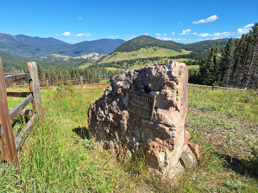
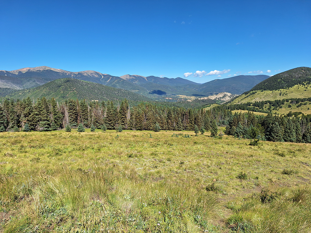
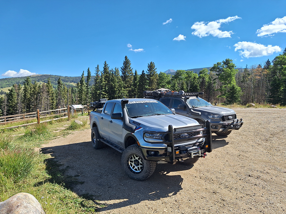
Leaving this area, we drove all the way to Alamosa to a Walmart so we could grab a couple of hoodies and a fleece blanket to put inside my sleeping bag. From there we finally made it to the WE RV Champions Campground in La Veta and were thankful to not have to do anymore driving for the day. After two days of not showering, it was nice to get a warm shower and not feel rushed to make dinner before the sun set. Later that day Kevin and his daughter Maggie showed up along with Mike and his girlfriend Jessica.
Eric was still in the Durango area and had fixed his leaky wheel seal but wouldn’t catch up with us for a couple of days yet. In case you’re wondering, no, we didn’t abandon him. I had spoken with him on the phone to assess the problem, suggested a solution, and told him we’d come to him if he needed us. He was able to work it out and fix it on his own.
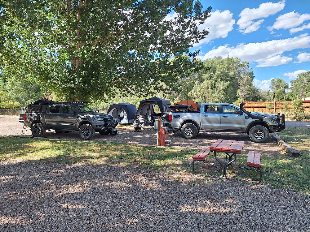
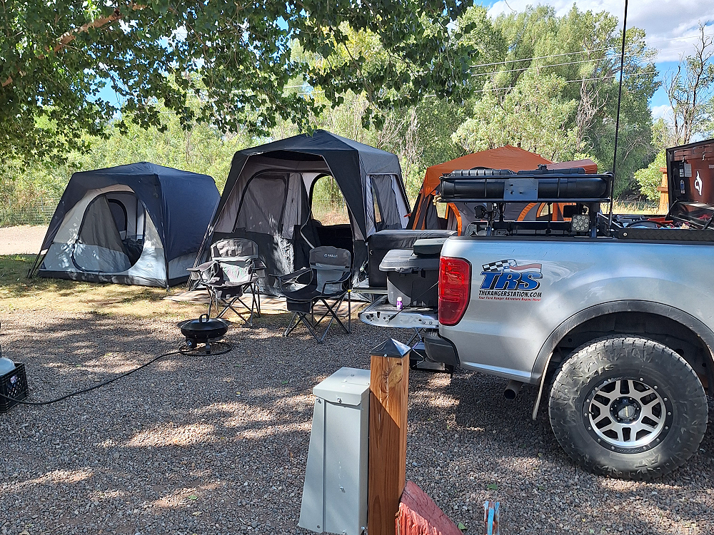
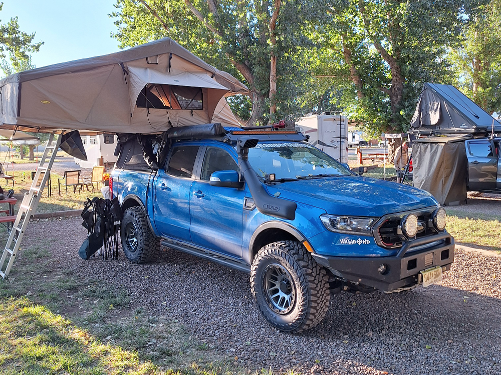
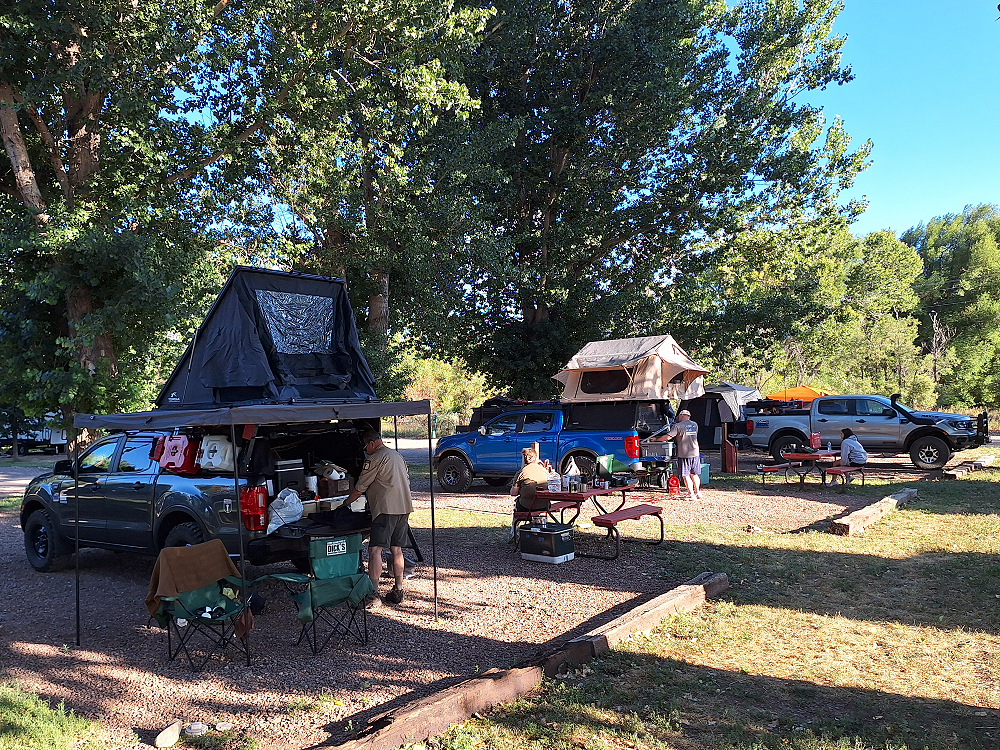
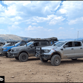
For reference, the gray Ford Ranger with the roof top tent is Mike’s, the blue Ford Ranger Tremor is Kevin’s, Robbie’s gray Ford Ranger is behind it, and the silver Ford Ranger FX4 is mine.
In case you’re wondering, I had planned this trip out several months prior and had created GPS files in GAIA GPS. Each member got a copy of the GPS files, so we all know where we’re going. Nobody is stuck depending on me or anyone else to tell them where we’re going, or where to turn. This is how we do all of our adventures. It also allows other people the opportunity to lead if they want to.
Tomorrow would be day five of this adventure but would be the first day of our official Vagabond Colorado Adventure 2025. From here it gets interesting.
Stay tuned!
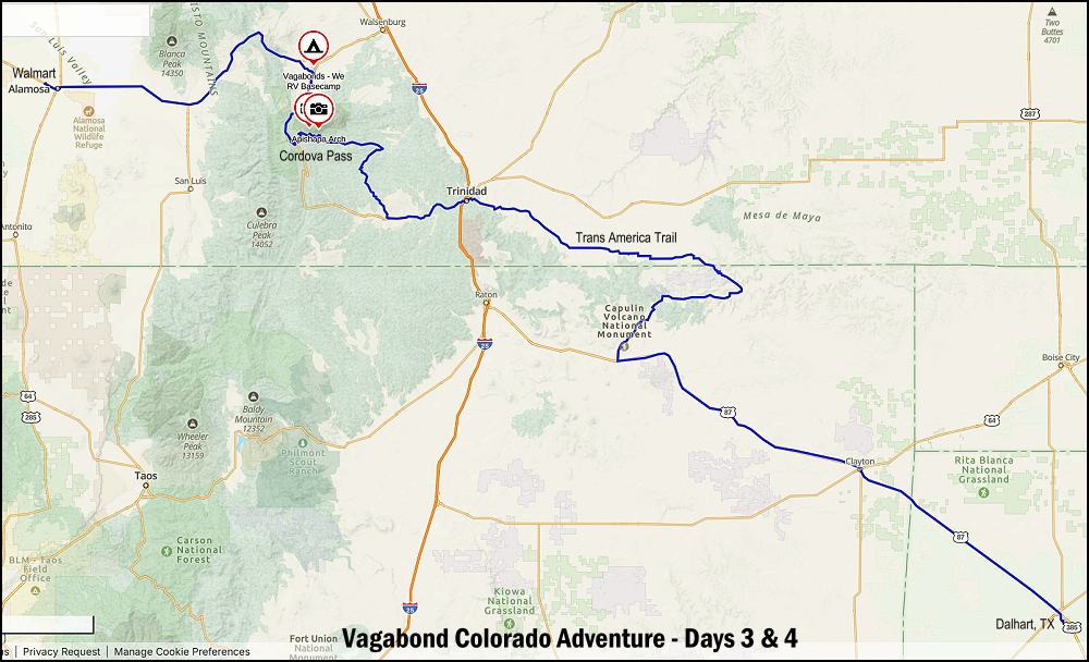
Vagabonds Colorado Adventure 2025 – Day Three & Four Map:
Check Out:
The Adventure Begins – Forum Discussion
Vagabonds Colorado Adventure 2025 – Day One & Two
Vagabonds Colorado Adventure 2025 – Day Five
Vagabonds Colorado Adventure 2025 – Day Six
Vagabonds Colorado Adventure 2025 – Day Seven
Vagabonds Colorado Adventure 2025 – Day Eight
About The Author
Jim Oaks is the founder of TheRangerStation.com, the longest-running Ford Ranger resource online since 1999. With over 25 years of hands-on experience building and modifying Ford Rangers — including magazine-featured builds like Project Transformer — Jim has become one of the most trusted authorities in the Ford Ranger off-road and enthusiast space.
Since launching TheRangerStation.com, Jim has documented thousands of real-world Ranger builds, technical repairs, drivetrain swaps, suspension modifications, and off-road adventures contributed by owners worldwide. TheRangerStation.com has been referenced in print, video and online by enthusiasts, mechanics, and off-road builders looking for practical, and experience-based information.

