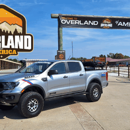
It Was Only Supposed to Be a Drive to Get Out of the House
I often say that life should be an adventure, and some of the best trips are the spontaneous ones that you don’t plan for. That happened to me on a Sunday afternoon in mid-July. I’ve lived in north Texas not far from the Red River for over five years. Having lived in Texas since 2016, I’ve heard and seen the names ‘Chisholm Trail’ and ‘Red River Station’, and while I know what they are, I had never really put that much thought into them or explored their history. This adventure would show me that there’s some fascinating history all around me that I wasn’t fully aware of.
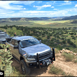
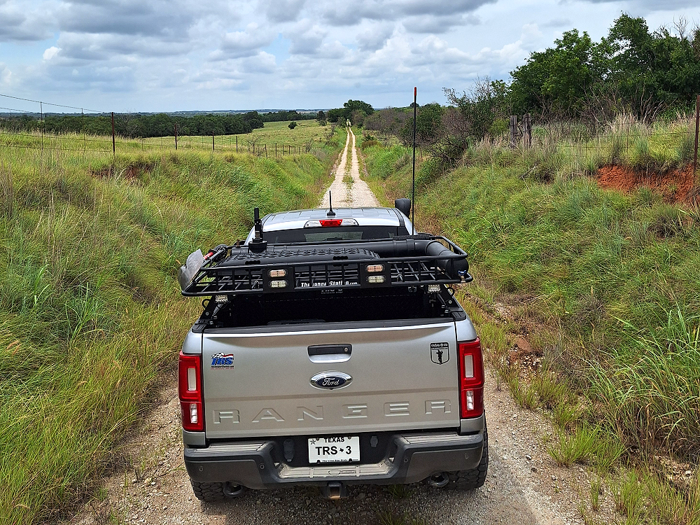
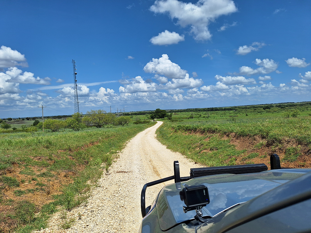
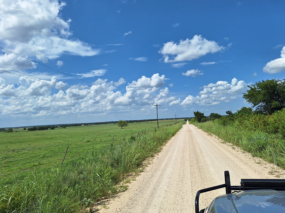
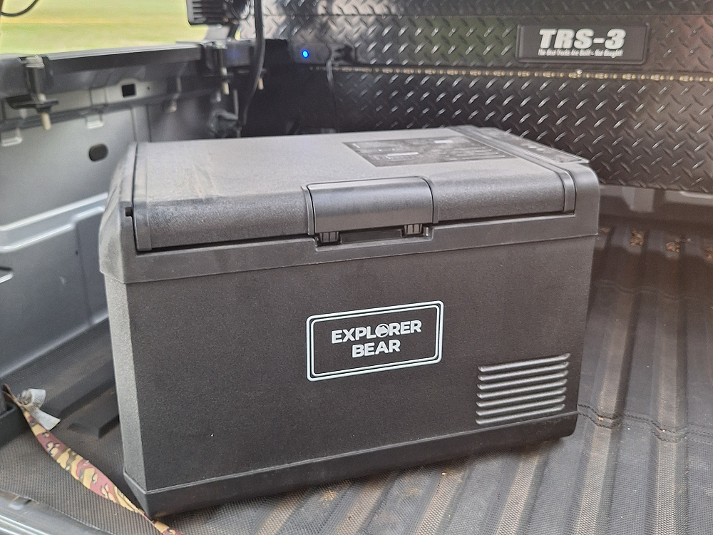
Wanting to get out of the house and away from my never-ending projects, I looked at my GAIA GPS app and found some ‘unmaintained’ roads not far from home and decided to go explore them and the beautiful Texas countryside. Unmaintained roads look like = = = = = on a map and can be anything from a gravel road to a dirt trail. It also gave me a chance to drive around for a few hours and test my new Explorer Bear 12V fridge in the bed, see how well it works, and make sure it’s not going to come unplugged or lose power before I take it on an adventure. I stuck a couple of sodas and bottles of water in it to test how cold they’d get as well. I also decided to take my Akaso Brave 7 action camera along since I haven’t had many chances to test its new mount on the exterior of the Ranger.
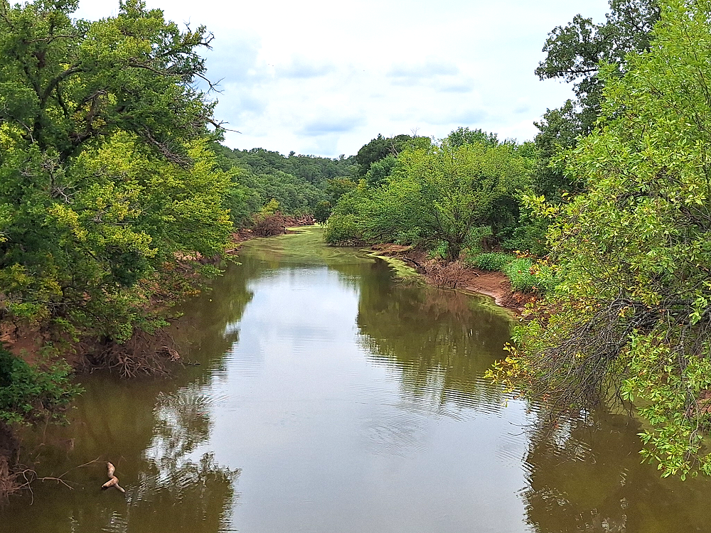
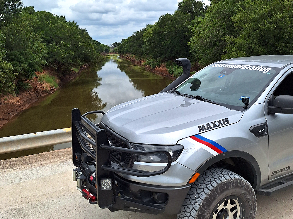
This bridge (above) is on Crenshaw Road north of Belcherville, Texas and crosses Belknap Creek about a mile upstream from where it enters the Red River. It was such a great view that I had to stop and take some photos. There was something about the green in the water that added to its beauty.
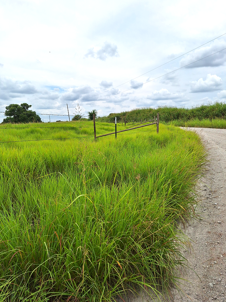
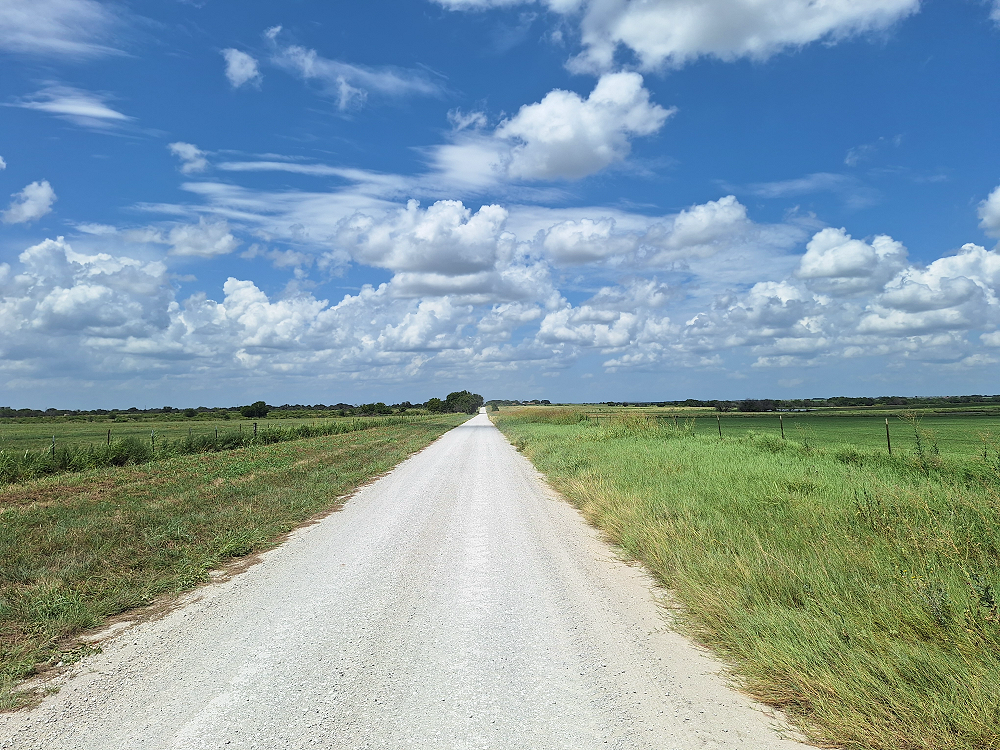
I don’t know why, but I was also really impressed by this tall thick grass and how bright green it was (below). Probably because it just doesn’t seem like it would be something you’d find in Texas. This may be the first time I’ve ever stopped to take a photo of grass. LOL.
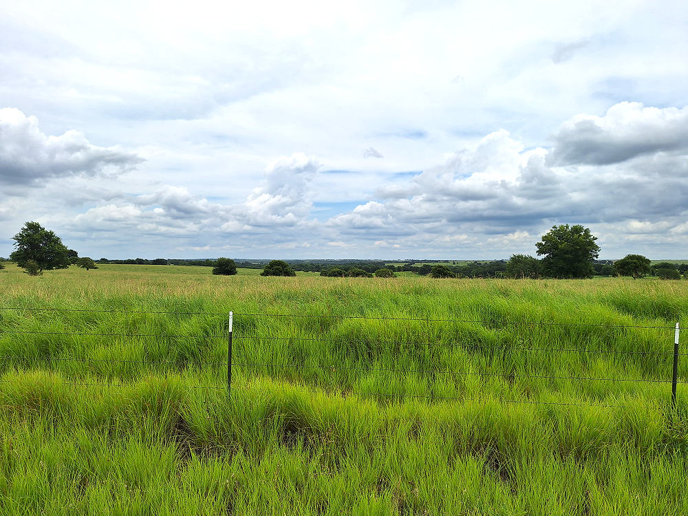
This is Texas and it’s beautiful. I’m not sure what I expected to find when I moved here, but it just might be greener than I thought it would be. The photo below faces east, and to the east and to the south are some beautiful rolling hills.
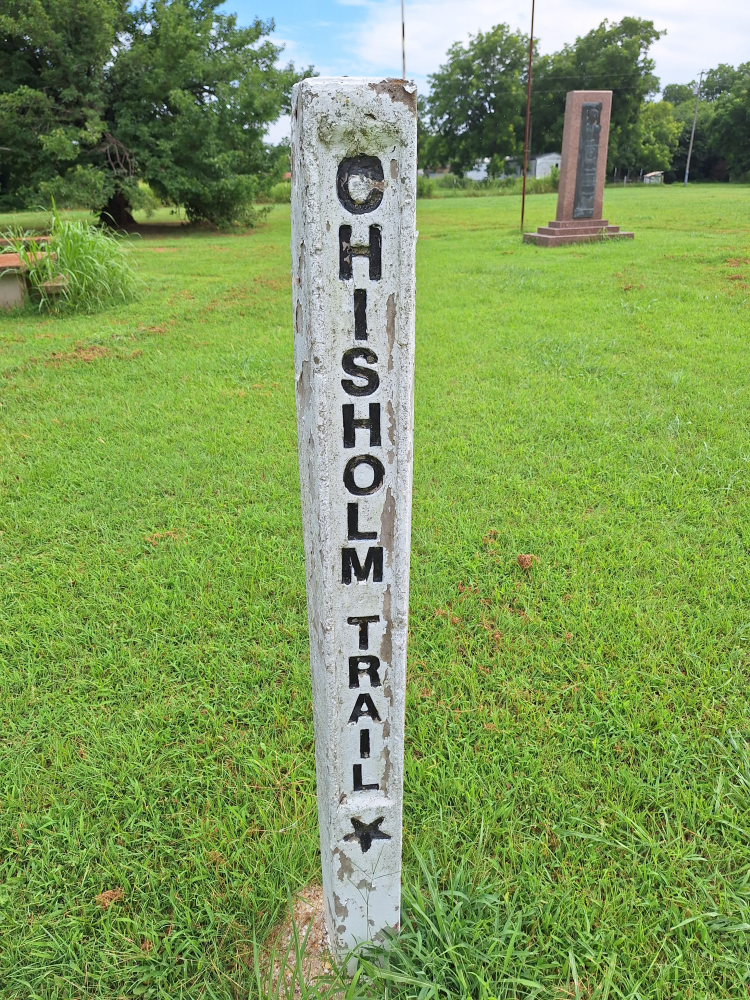
Re-Discovering Red River Station, Texas
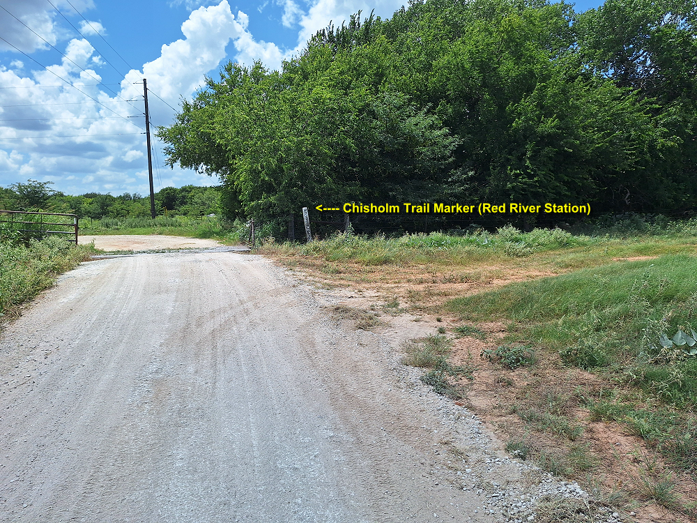
The gravel roads lead me to the site of Red River Station and the Chisholm Trail marker and monument. I’ve actually been here once before, and while I know what it was, I never really explored the history of it until now.
Here, the Red River makes a distinct bend to the north pushing the current to the south bank creating a favorable crossing point. The crossing had been used by buffalos and Native Americans long before Red River Station ever existed.
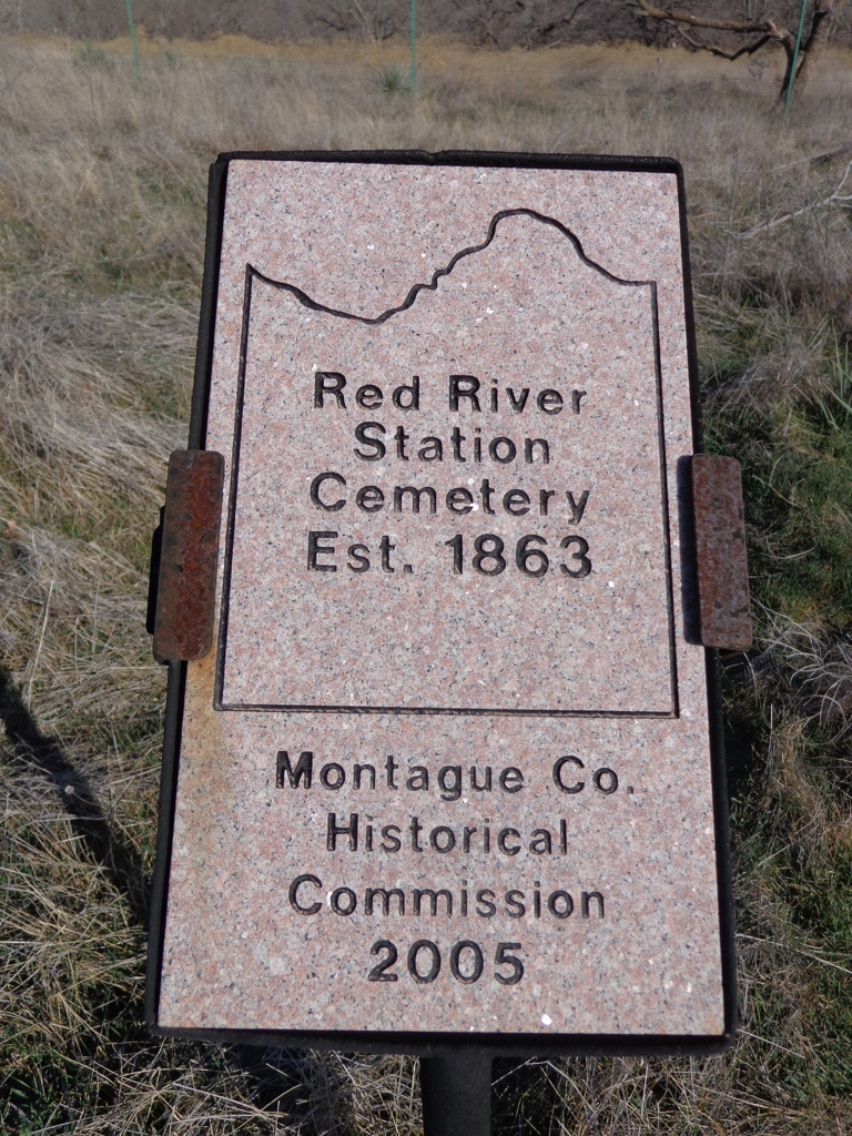
This area was settled between 1857-1860. In July of 1861 a company of Texas Rangers was sent here under the command of Captain Brunson to help defend the settlement against Indians. Their camp was first known as Camp Brunson.
During the civil war, Texan’s weren’t able to move their cattle north to market, but that didn’t keep the cattle from breeding and having calves. When the civil war ended in 1865, Texas ranchers had a surplus of some 5-million cattle. With such an abundance, they were only worth $3 or $4 dollars a head. But to the north and east, those cattle could go for $40 a head. Many of the cattlemen were “cattle rich but cash poor.” The trouble was getting the cattle to market in the north.
In the spring of 1866 about a quarter of a million cattle moved out of Texas through Oklahoma and Arkansas headed to Sedalia, Missouri which was the closest railroad. Ranchers needed the railroad to ship their cattle to markets in the east.
Farmers in Missouri and Kansas stopped allowing Texas cattle to move north across their land because the Texas cattle had a disease known as splenic fever, or “Texas Fever.” The disease was spread by ticks attached to the Texas cattle that killed thousands of domestic cattle in the north. Texas Longhorn cattle had thick hides and could resist many infectious diseases that would lay low cattle of other breeds.
Armed men would turn back herds of Texas cattle and not let them pass. This armed resistance and the quarantine law passed by the Missouri legislature in 1866 made it impossible for Texas ranches to get their cattle to the north.
Kansas had their own quarantine line and only allowed Texas cattle to the south and west of what is now McPherson, Kansas.
Joseph McCoy seeing an opportunity, left a prosperous farm in Illinois in 1867 and went to Abilene, Kansas along the new Kansas Pacific Railway where he worked out a deal with the railroad to haul Texas cattle back east. McCoy also had to negotiate an agreement with the local farmers and convince Samuel Crawford, Governor of Kansas, to allow Texas cattle within the quarantine lines. McCoy built loading pens and sent men to Texas to locate herds and guide them to Abilene.
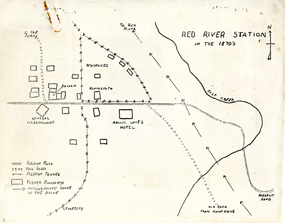
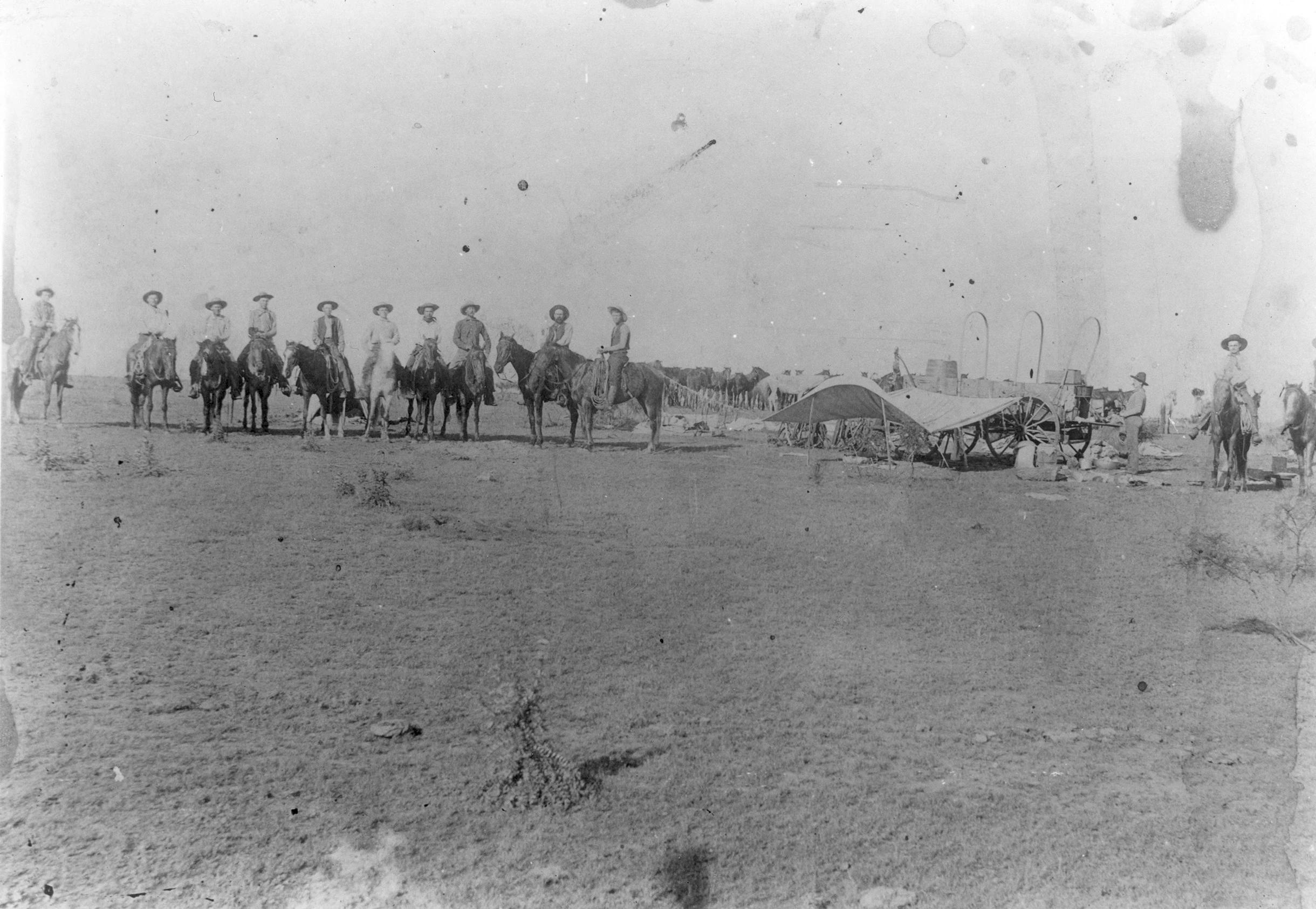
The Red River Station area really boomed when drovers started bringing cattle here in 1867 to cross the Red River on their way to Kansas. The town, originally named Salt Creek after the creek it sits next to, had a post office, saloon, trading post, mercantile, several blacksmiths, and leather repair shops. Dr. J.S. Love and his wife Mollie built a two-story hotel here. Mollie was known to feed the hungry regardless of their ability to pay and often nursed the sick back to health. The Red River Station Inn in nearby Nocona actually has a Molly Love hotel room named after her. Other businesses that were established included Tom Pollard’s Saloon and Trading Post and W.S. Thurston’s General Mercantile. A school was formed in the basement of J.M. Grayson’s home until an actual school was finally built. There was a chain ferry about a half a mile west of town that charged a toll. The towns name was changed to Red River Station in 1884.
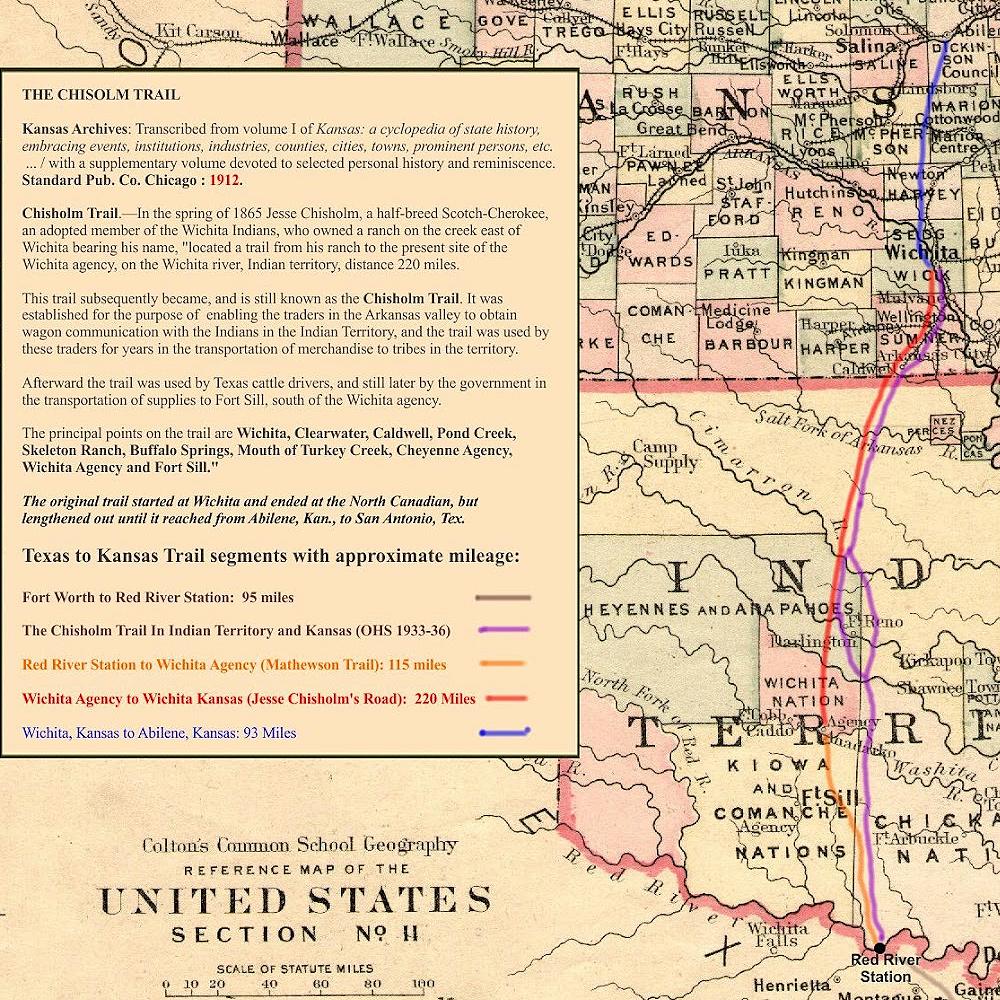
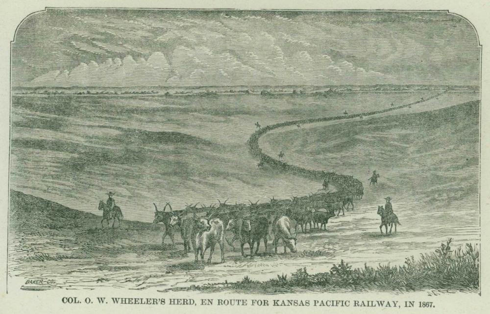
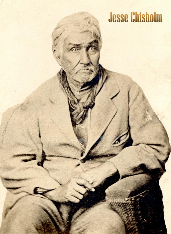
Col. O.W. Wheeler was one of the first to make the journey north to Abilene in 1867, leading about 2,400 head of cattle from San Antonio to Abilene. When Wheeler and his men reached the North Canadian River in Indian Territory (Oklahoma), they saw wagon tracks and chose to follow them. Those tracks were the wagon trail made by Jesse Chisholm. The cattle trail from Red River Station to Kansas was known as the Abilene Trail, but some cowboys called it the “Chisholm Trail” as it met with a more established trail at the North Canadian River by Jesse Chisholm’s Store.
Jesse Chisholm was a Scotch-Cherokee fur trader, merchant, and an adopted member of the Wichita Indians. Chisholm travelled between his trading post at the mouth of the Little Arkansas River (now Wichita, Kansas) south to his trading post at Council Grove along the North Canadian River, just west of what is now Oklahoma City. Chisholm would travel further south to Wichita Agency (Near Anadarko, Oklahoma) and trade there as well. This trading route between Wichita Agency and Wichita, Kansas became known as Chisholm’s Trail.
Although it was initially called the Abilene Trail, it didn’t always go to Abilene. In 1872, due to an increase in domestic livestock deaths related to Texas Fever and an ever-growing problem with unlawful cowboys, Abilene passed an ordinance prohibiting Texas longhorns, making it necessary for ranchers to find new railheads to ship their cattle from.
The Texas feeder trails heading to Red River Station in Texas didn’t have names, and the trail to Kansas began shifting as ranchers found new railheads to ship from. Over time, the whole trail system including those in Texas heading for the Chisholm Trail became known as the Chisholm Trail. Jesse Chisholm died of food poisoning in 1868 and would never see what his trail had become.
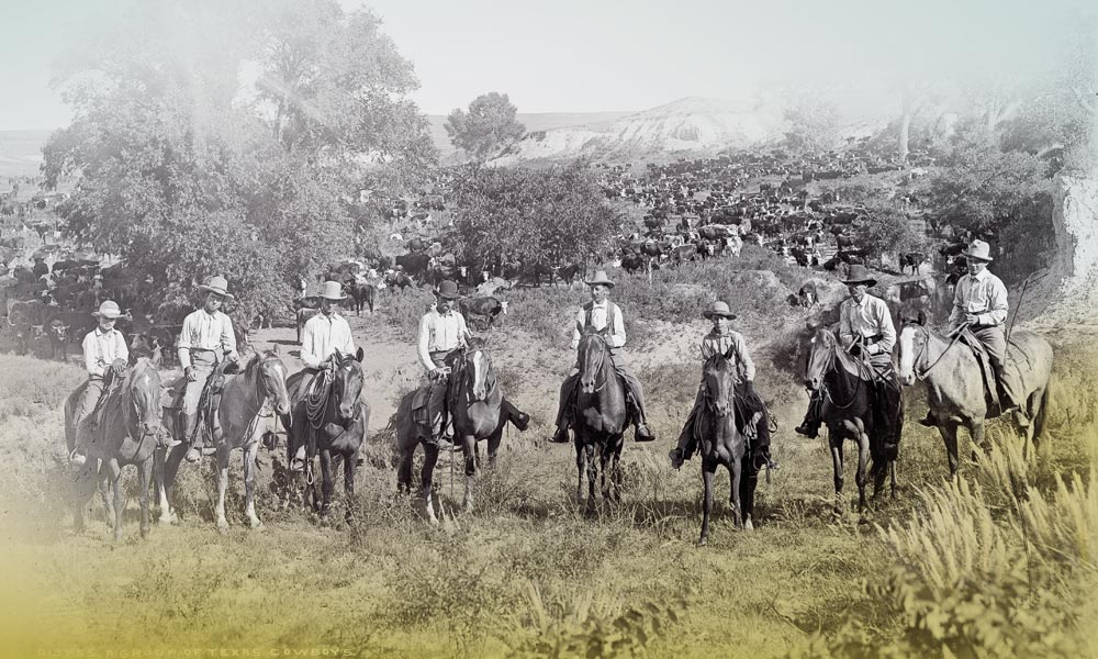
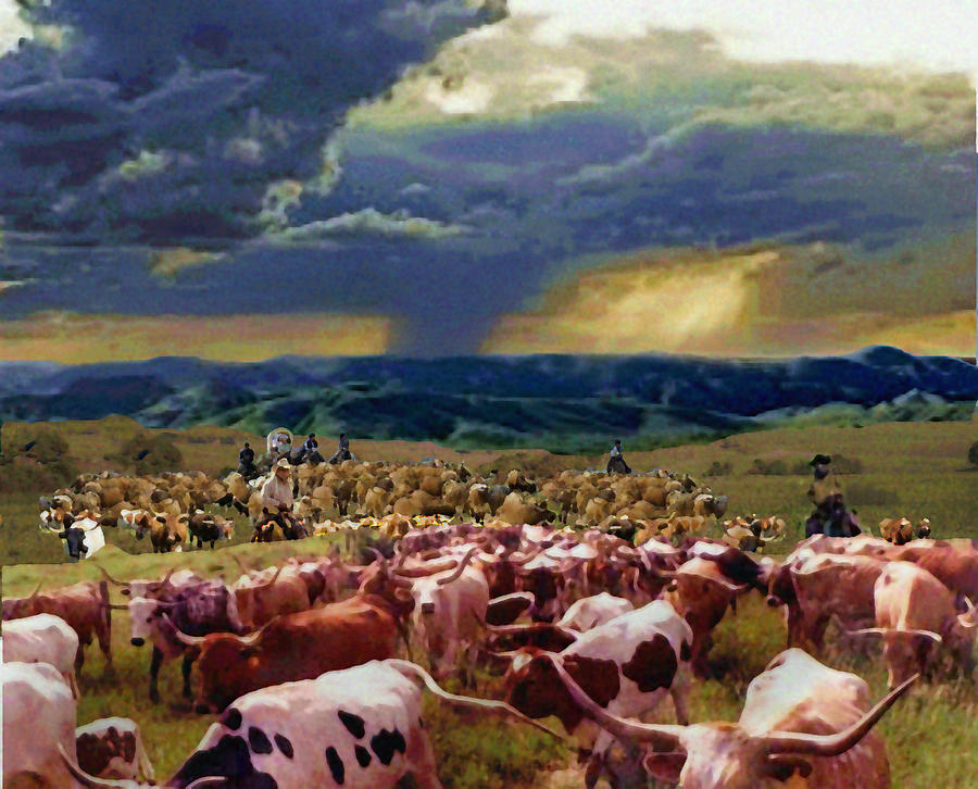
Ranchers all over Texas would drive their cattle to Red River Station where they would cross the Red River and follow the Abilene trail to the railroad in Kansas. In a letter from June 1873, cowboy J.V. Shiner wrote that his outfit had “been encamped here five days, waiting for the Red River to fall. It has been consistently raining for eight to ten days, and the river has been very high. It is estimated that there are about 30,000 cattle in this vicinity waiting to cross the Red River.”
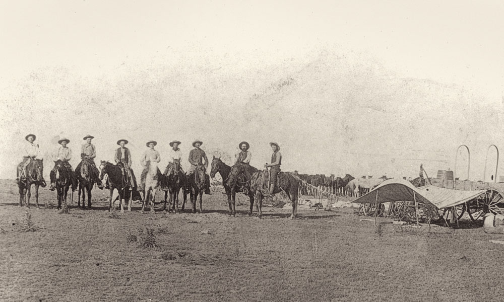
Typically, a herd would consist of 2,500 cattle, a dozen cowboys, extra horses, and a chuck wagon for food and gear. On the trail the cattle were watered in the morning, and then they slowly ate their way northward. The cowboys kept them from stopping, turning back, or leaving the herd. The herd would walk about ten miles per day, stopping only to water and eat. At night the herd would stop at a watering hole and bed down. It took cattle leaving the southern part of the state six weeks to two months to cross Texas and get to Red River Station. Then it would take another four weeks or more to move the herd across Indian territory into Kansas. At the Abilene railhead the trail boss would sell the cattle and horses, pay the cowboys, and return to Texas with the money for the owner, often repeating the trip year after year.
Quarantine laws and land owners putting up barbed wire fences put an end to the cattle drives up the Abilene Trail. In 1875 a new “Western Trail” opened up about 90 miles west of here and cattle now crossed the Red River at Doans Crossing on their way to Dodge City, Kansas. That trail was used until 1884. From 1875 until 1880, the Chisholm Trail became a feeder route into the Western Trail.
It is estimated that 10 million Longhorn Cattle went up the Chisholm Trail and the Western Trail before new railroad lines to Texas made the long trail drives no longer necessary. 10 million head of cattle at $40 a head would be $400 million or $8.68 billion today with inflation. That really shows how significant these cattle drives were to the Texas economy.
When the Gainesville, Henrietta and Western Railway (1886) crossed northern Montague County, it bypassed Red River Station and was about 5-miles south where Belcherville and Nocona are now. With the influx of cattlemen gone and new towns springing up along the railroad, the population of Red River Station dwindled.
A tornado struck Red River Station in the late 1880s, destroying much of the community. Rather than rebuild, citizens moved south to the communities along the new rail line and Red River Station again became farmland. In 1887, the post office closed, and the community ceased to exist.
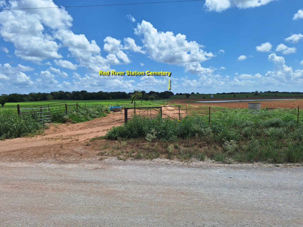
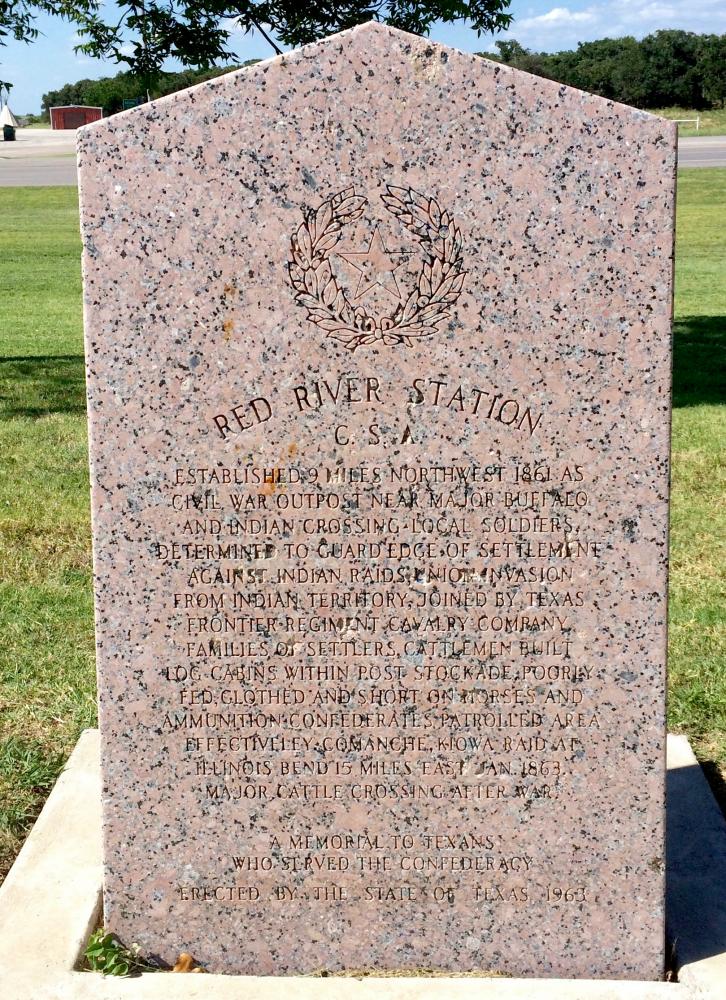
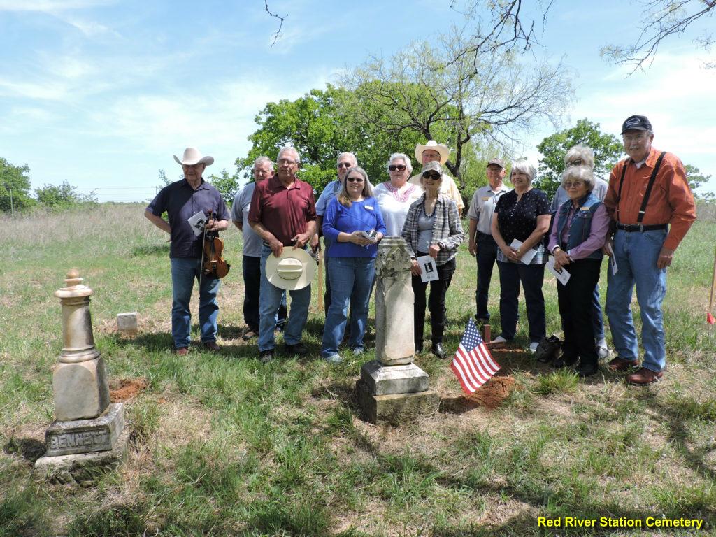
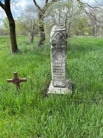
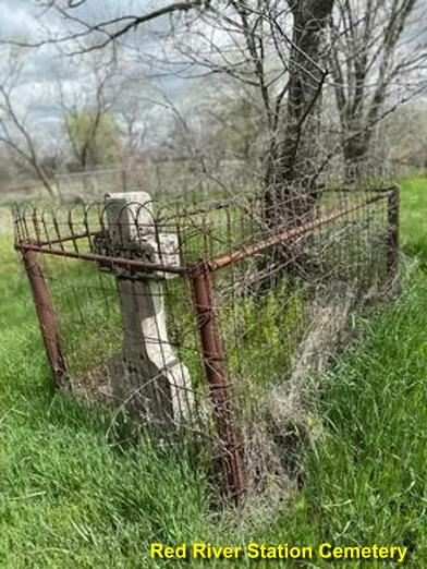
All that exists today is the Red River Station Cemetery, a monument along the tree line near where the cattle crossed, and a Chisholm Trail marker.
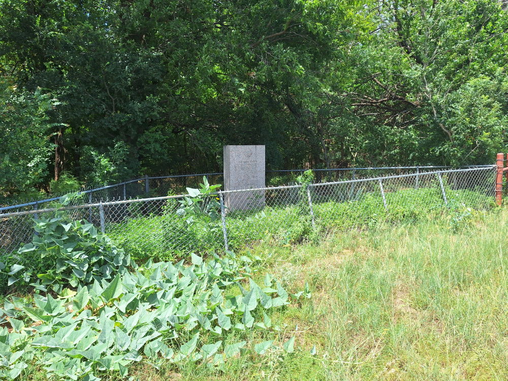
Red River Station monument along the tree line at the west end of the field (North side of road).
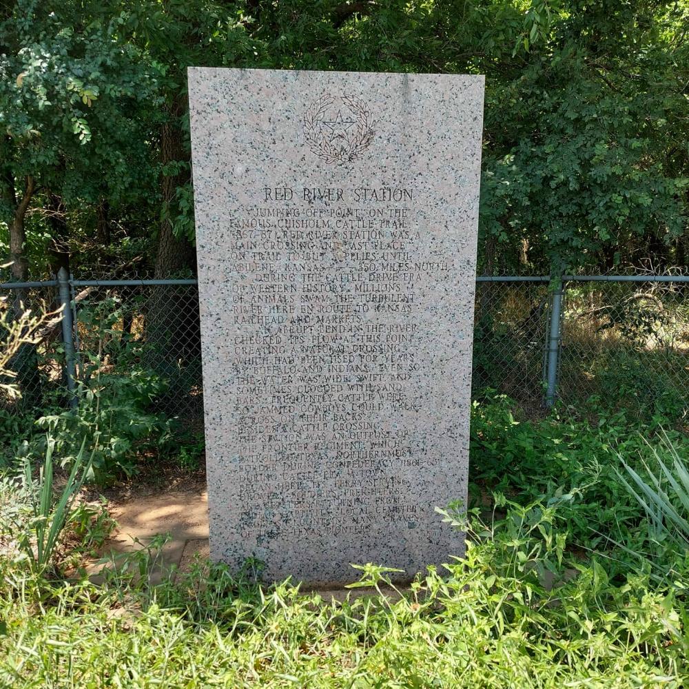
The inscription reads:
Red River Station. “Jumping-off point” on the famous Chisholm Cattle Trail, (1867-87), Red River Station was a main crossing and last place on trail to buy supplies until Abilene, Kan.–350 miles north. During the cattle drive era of Western history, millions of animals swam the turbulent river here en route to Kansas railhead and markets. An abrupt bend in the river checked its flow at this point, creating a natural crossing which had been used for years by buffalo and Indians. Even so, the water was wide, swift, and sometimes clogged with sand bars. Frequently cattle were so jammed cowboys could walk across on their backs. Besides a cattle crossing, the station was an outpost of the frontier regiment, which patrolled Texas’ northernmost border during Confederacy (1861-65). During cattle era, a town began here, its ferry serving drovers, soldiers, freighters, and settlers returning from Indian captivity. Local cemetery (1 mi. SE) contains many graves of these Texas pioneers.
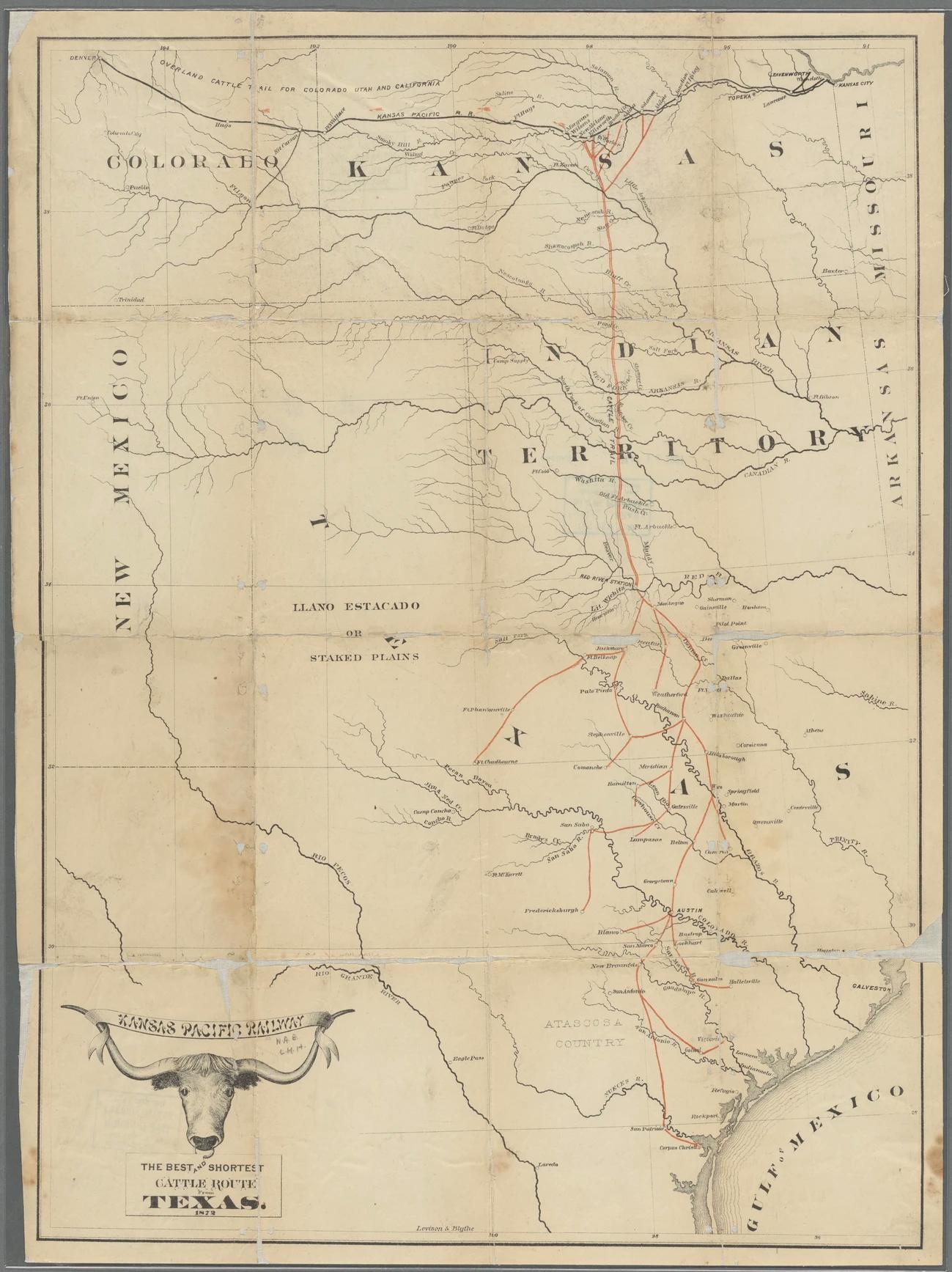
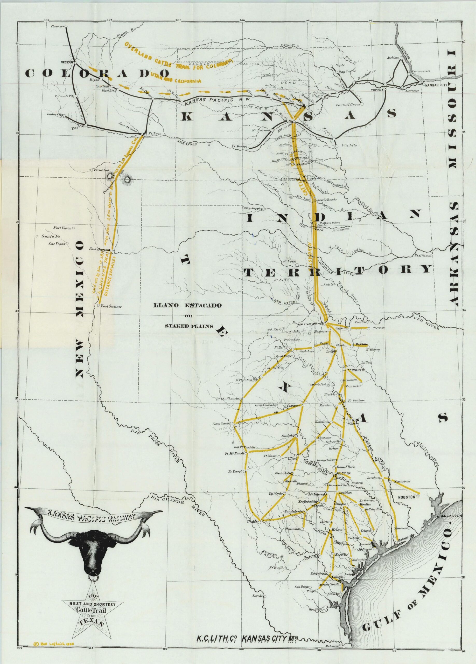
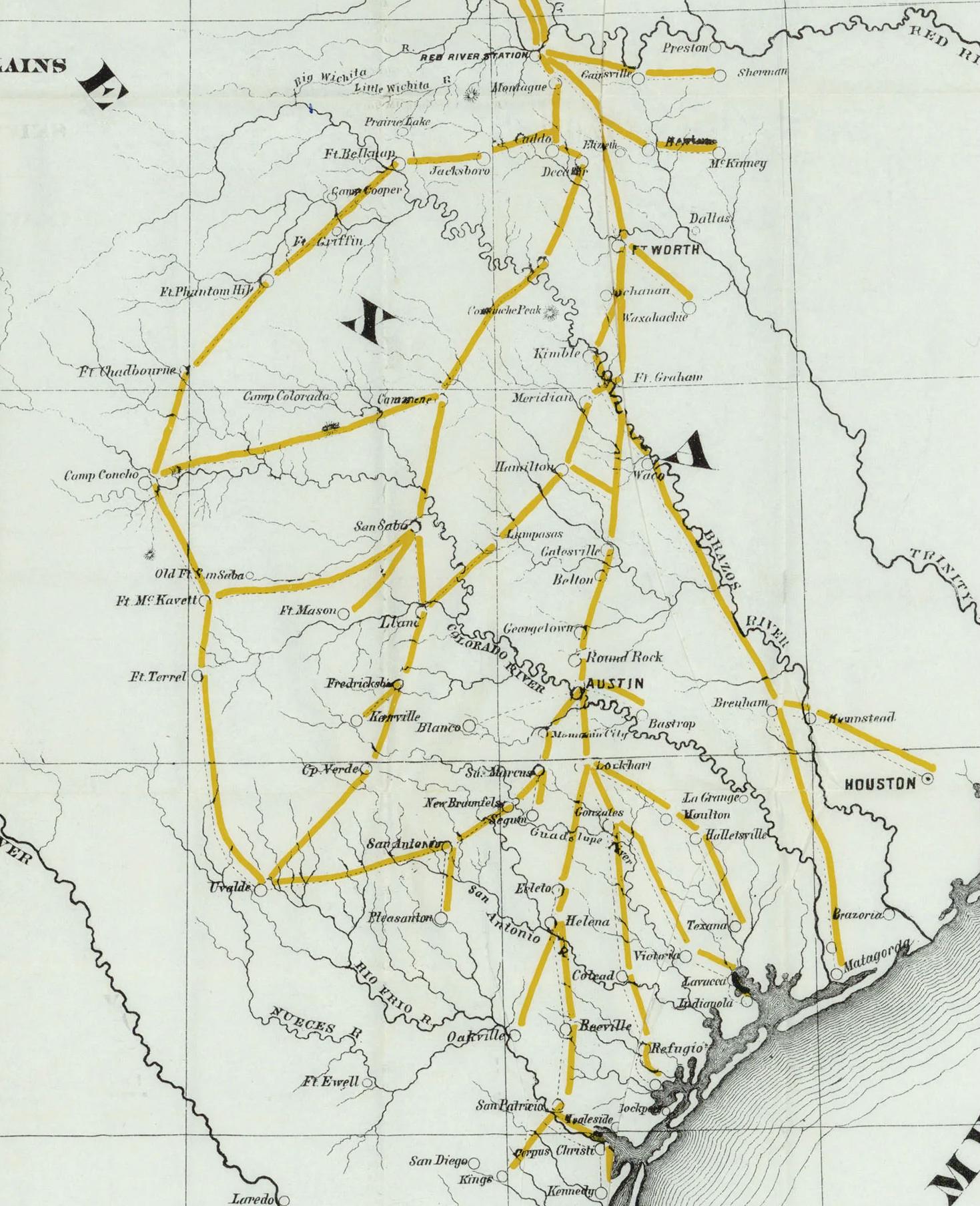
Red River Station, Texas Map
Below is a map of Red River Station. I also included a screenshot from Google Maps and labeled it using the map drawings to try and get a better feel for where the town and cattle trail were.
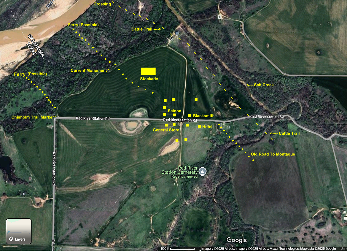
Looking at the photo above, the road once made a ‘Y’ where that bend is and if you went to the right, it would take you to the cable ferry to cross the Red River.
Heading To Spanish Fort
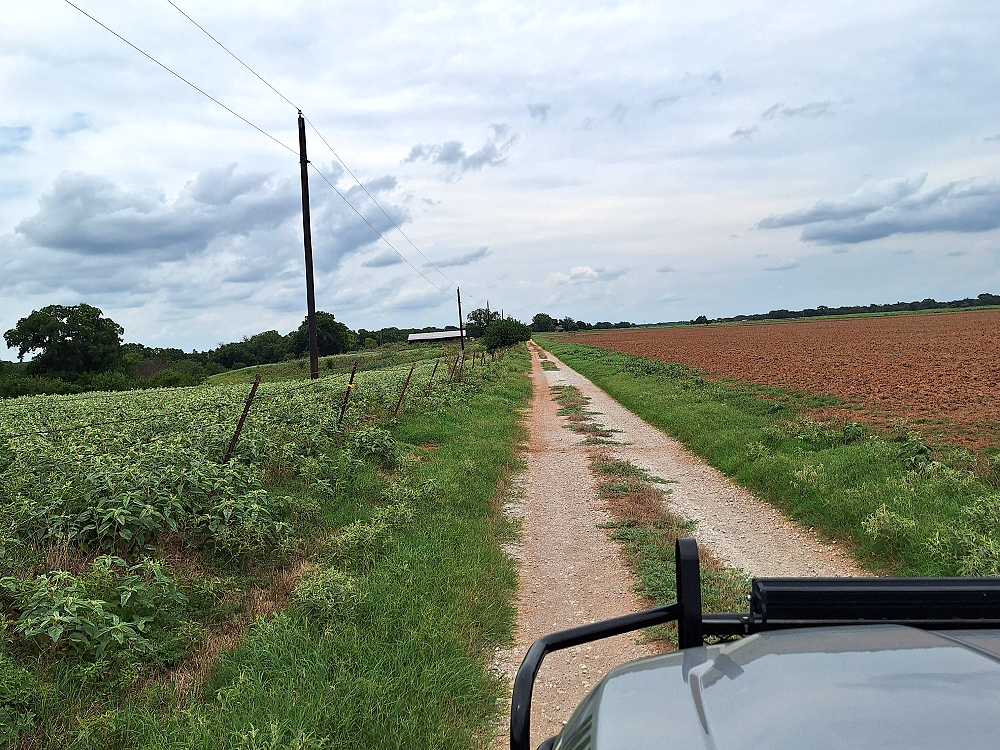
I decided to head to Spanish Fort, Texas, but stuck to the remote gravel roads on the way there. Spanish Fort sat along the Red River 11-miles east of Red River Station and was an area that the drovers (cowboys) liked to go to before continuing their journey north from Red River Station.
Leaving Red River Station headed east you’ll pass along the banks of the Salt Creek and then cross over it a short distance later.
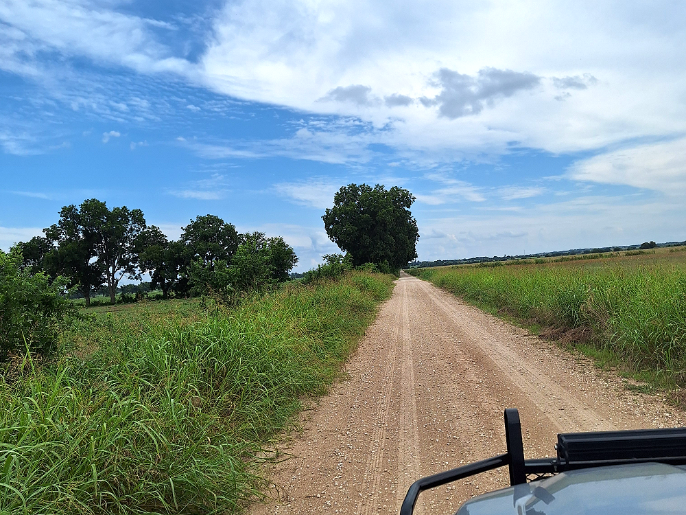
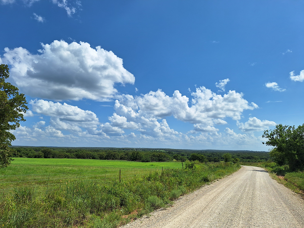
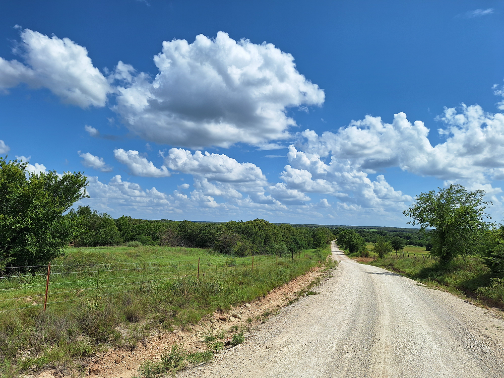
The trip to Spanish Fort proved to be an enjoyable drive. I did manage to stay off of paved roads most of the way there and a couple of the roads had grass growing between the tracks from lack of use.
Sometimes what your GPS lists as a road is no longer a public road. So, I get a little nervous exploring gravel roads when they look like they’re leading up to someone’s house or barn. At least twice the road looked like it was going to end on someone’s property but continued on.
Some roads had cattle grates in them, but I didn’t come across any cattle in the road.
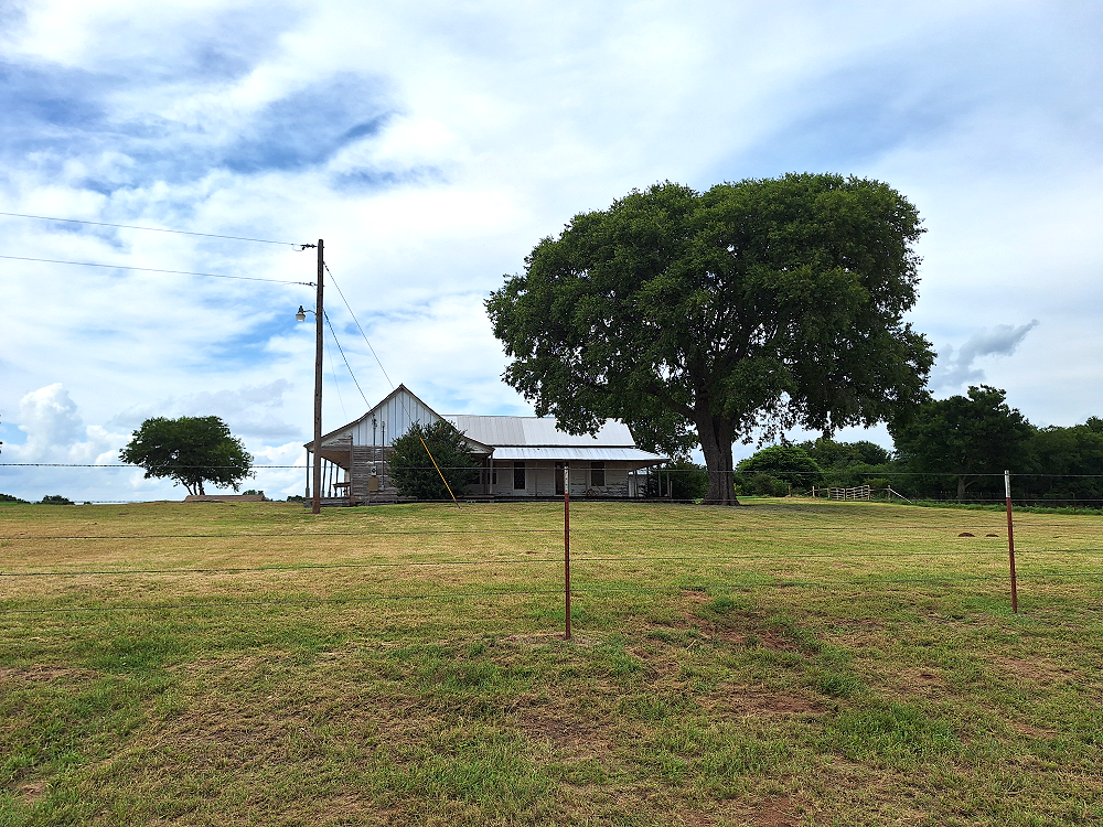
I spotted several old, abandoned homesteads while exploring these roads. Sometimes it’s like taking a step back in time, which I found enjoyable since I’m exploring history from the later part of the 1800’s.
This road (above) is a section of Gray Road and was a road that I thought was going to end at someone’s barn. This picture was taken after passing the house and barn and realizing that the road continued.
Below was one of those old, abandoned homesteads. There’s a newer home close by that I suspect is on the same property.
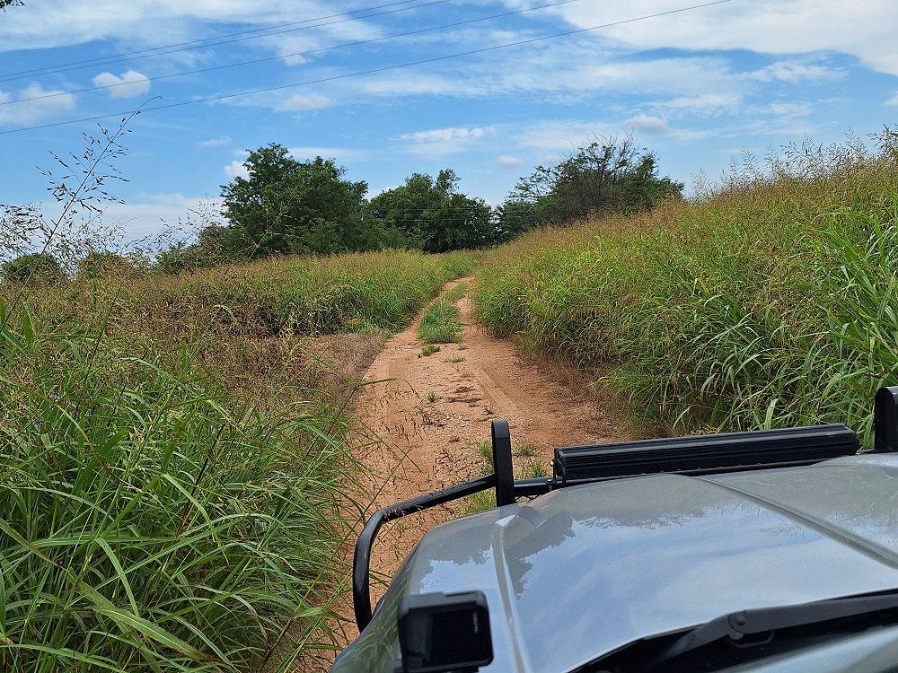
At one point I did finally run out of road. Google maps showed that the road ended, but GAIA GPS showed that it led to an unmaintained road and would come out on a state highway. It did not. I do believe that there was a trail through the tall grass, but it would be my luck that it would take me up to the back of some rancher’s house. After turning around and getting out on the main road I did see where the trail allegedly came out at. The problem is that there are a lot of oil fields up in this area, so sometimes the road only goes as far as a well and is then abandoned.
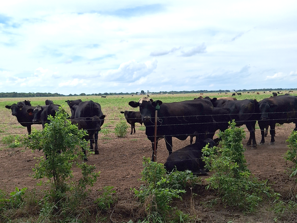
I saw a lot of cattle, but they were all behind fences.
I came to a point where there were two different ways that I could continue on gravel roads, and this one below was one of them. This is Continental Camp Road. Continental Camp Road starts out as one road and then forks and goes in three different direction and comes out on the same road in three different places, and they’re all called Continental Camp Road. This road is FedEx’s worst nightmare. These roads covered a good size area and there was nothing out here but one house and a bunch of oil wells. And as luck would have it, I ended up on the road that went past the house. Russell Road which was the other route option north of here proved to be a better option.
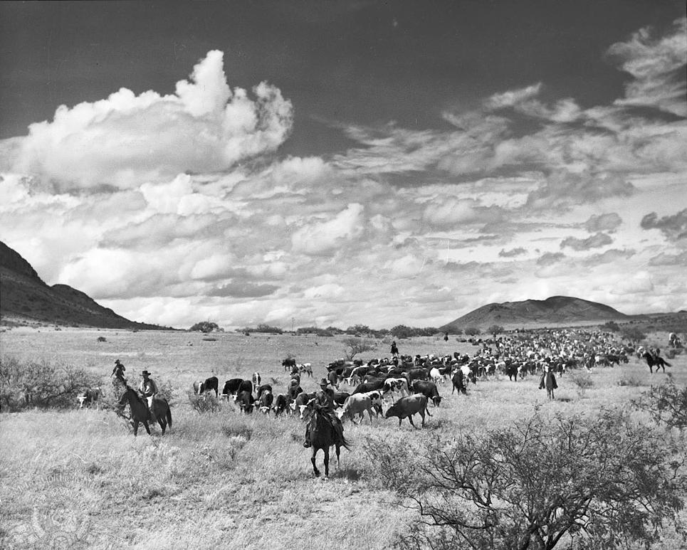
Looking at the photo below, can you imagine what it must have been like to travel across these fields driving cattle north 1,000 miles to Kansas? Every day you go as far as you can go, camp for the night, and hope that nobody attacks you or that none of the herd comes up missing. These were long tiring trips taking 6-8 weeks or longer. By the time you got to Kansas you likely wanted some good food, a bath, and an actual bed to sleep on.
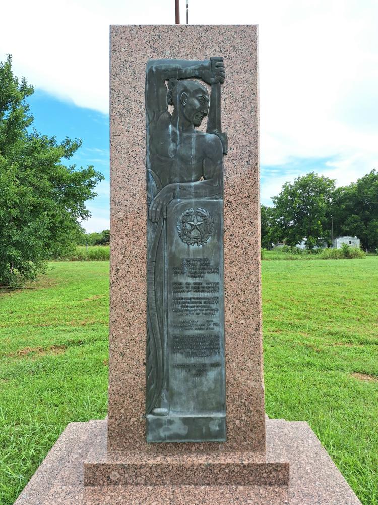
Spanish Fort, Texas (Not Spanish – Not A Fort)
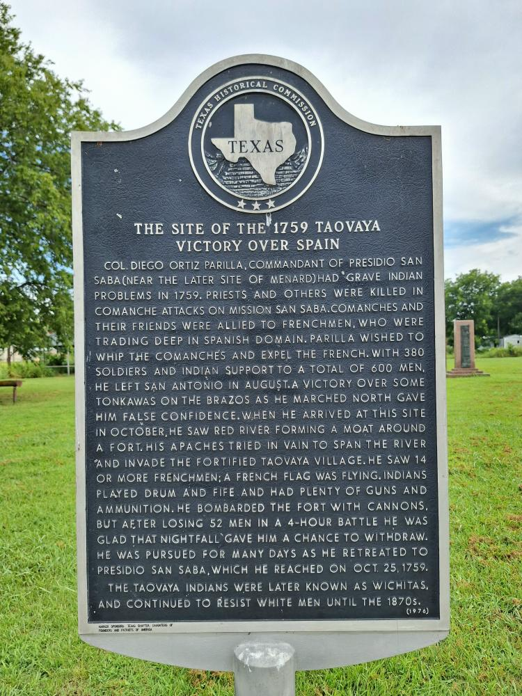
According to Spanish records, the Taovaya Indians built a settlement here between 1750 and 1757. In 1759, Col. Diego Ortiz Parrilla (Spain) oversaw a campaign to expel the Taovaya and Comanche Indians from the area. The Taovayan town had an estimated population of 6,000 and was fortified with entrenchments and wooden stockades when several hundred Spanish soldiers arrived. Four hours of fighting ended with the Spanish retreating. They even abandoned their two cannons and baggage train.
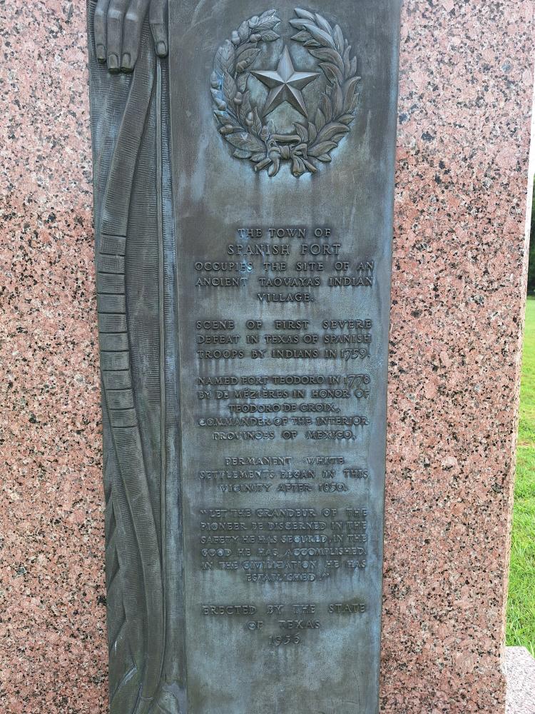
Even after Spain gained control of Louisiana in 1763, the Spanish continued to rely on the French to maintain relationships with the Indians along the Red River. Frenchman Athanase de Mezieres, Lieutenant Governor of Spanish Louisiana, tried to re-establish communication with the tribes along the western Red River. He wrote that the Nortenos continued to be defiant against the Spanish. He also described the Taovayan village as spanning the Red River, with a sizeable population on the Texas side of the river. De Mezieres christened the Texas side of the village San Teodoro and the Oklahoma side, San Bernardo.
Smallpox epidemics that started in 1778 and American expansion following the Louisiana Purchase in 1803 destroyed the Taovayan population. The Taovayas abandoned their fortification in San Teodoro (Texas side of river) around 1841, allowing it to deteriorate. The Taovayas had long since left, so an early white settler who visited the ruins in 1859 didn’t know anything about the area and its history and imagined it had been a former Spanish fort.
By the early 1870s a town called Burlington had developed here. It served as a watering-hole for cattle drivers headed for the Chisholm Trail. Stockmen on the trail bedded their herds at Red River Station, then rode to nearby Burlington for supplies and entertainment (This is why I headed here after leaving Red River Station). The town grew quickly, and local citizens applied for a post office in 1876, but postal authorities rejected their request because another post office in Texas had the name. So, the citizens renamed it in honor of who they thought had lived there previously — Spanish Fort.
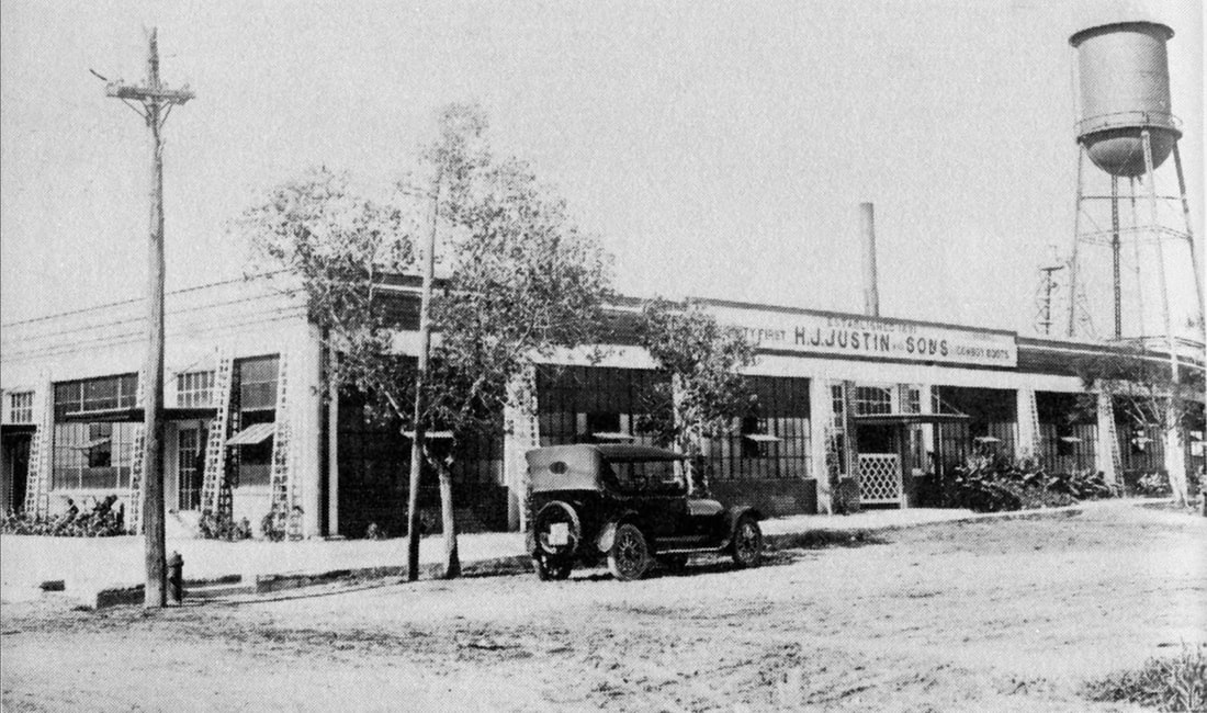
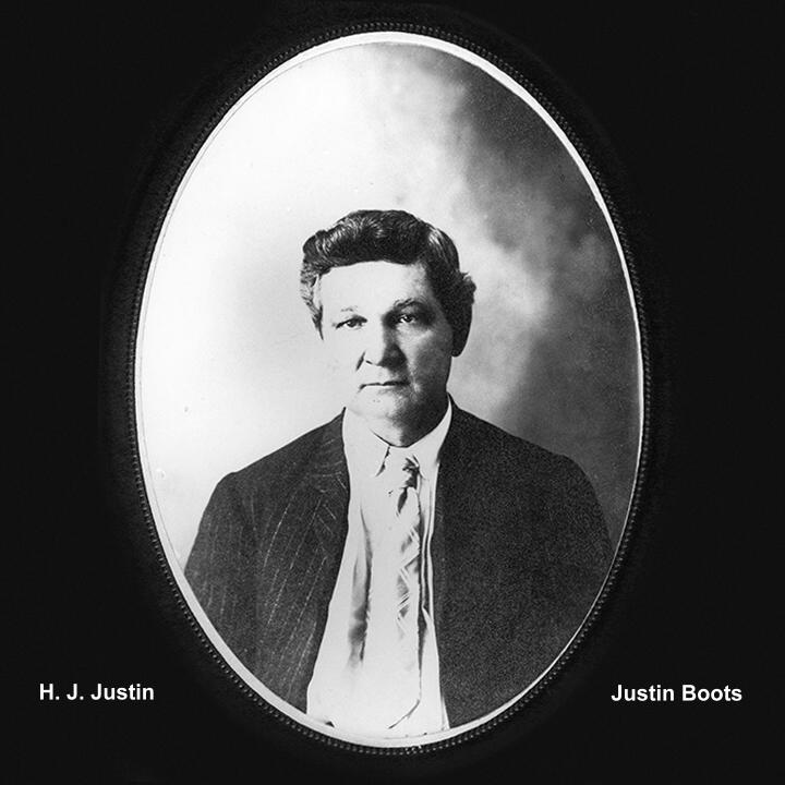
At its peak, the town had numerous businesses and churches, a Masonic lodge, five physicians, four hotels, and several saloons, the most popular of which was J. W. Schrock’s Cowboy Saloon, where cattle men collected to drink and swap stories. On the town square, Herman J. Justin founded the boot company which later grew into Justin Industries (Justin Boots). Justin took orders from the drovers going north and had their custom boots ready in time for them to pick up on their way south again.
By 1885, there were 300 residents, but Spanish Fort gained a reputation as a nasty town. Later, Justin’s wife claimed that during the height of the cattle industry, there had been over 40 killings; in fact, on one Christmas morning, three men had been murdered before breakfast. Outlaws hiding out in Indian Territory traveled across the Red River to Spanish Fort to get supplies, frequently starting “affrays” that further troubled the town.
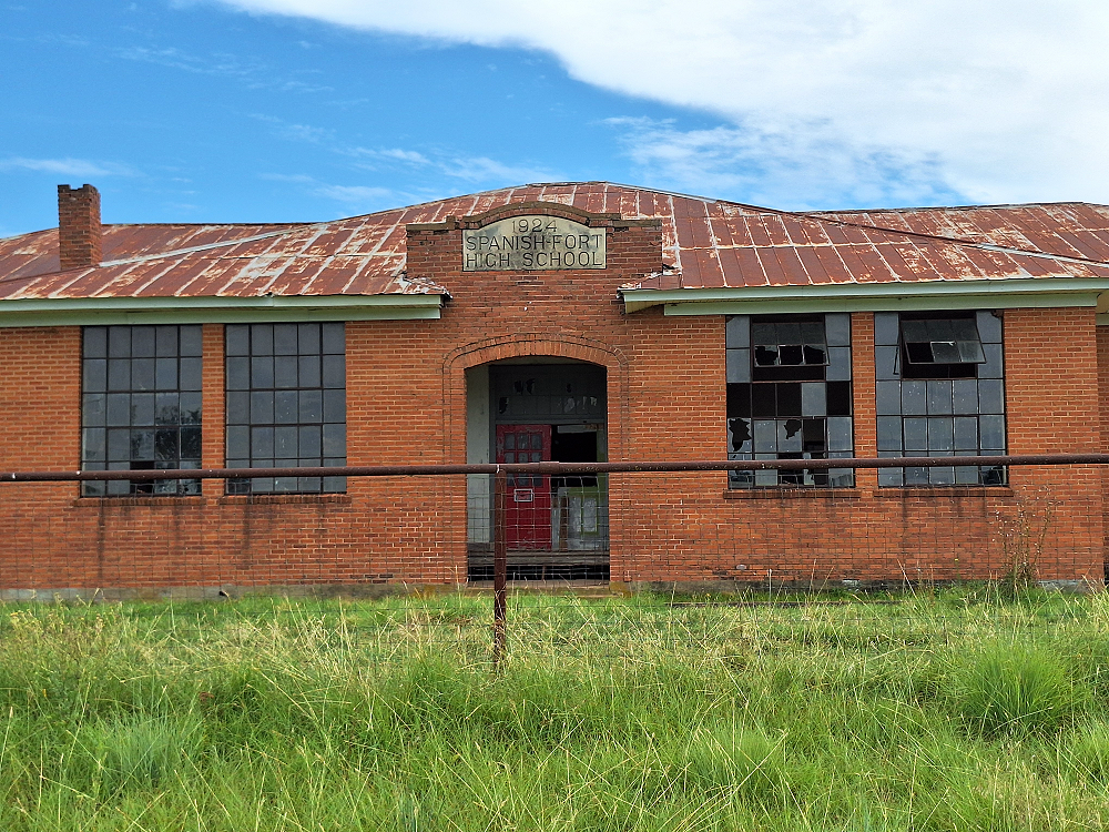
Spanish Fort was doing very well until the railroad came through in the late 1880s. A new town, Nocona, was platted about 15 miles south, and Spanish Fort began losing population to this new town. Spanish Fort rebounded in the 1920s when oil exploration made its way to the fields outside of the town. The brief boom that ensued helped to fund a new, brick school in 1924, but a major explosion in a nearby well and several dry wells hurt Spanish Fort’s viability. By the late 1960s, Spanish Fort began to shrink until ultimately, it became the ghost town it is today.
There are still a few people living in Spanish Fort.
Next Stop: Saint Jo, Texas
Another notable stop on this journey is Saint Jo. Unfortunately, I had to go about 6-miles on pavement heading south out of Spanish Fort before I could get back on gravel. My first attempt at a gravel road only lasted about 1,200 feet before I came to an open gate that had a post and keypad next to the road. This was actually listed as a named road on Google Maps and showed it connecting with the road I eventually ended up on. Had I not noticed the keypad, I would have kept going down the road, past the residence, and eventually ran out of road. Not a big deal. It was only 3/4 of a mile to the next gravel road.
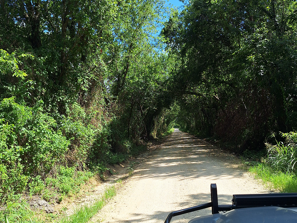
Not only was this last section a beautiful drive, but it also led me into a section of trees that umbrellaed over the road and made it look like you were driving into a tunnel.
Right before I got to Saint Jo I ended up on Talley Road. Part of Talley Road is actually the old railbed of the Gainesville, Henrietta and Western Railway. I saw the old railbed earlier on Crenshaw Road before Red River Station. There’re not many places where you can actually see the old railbed.
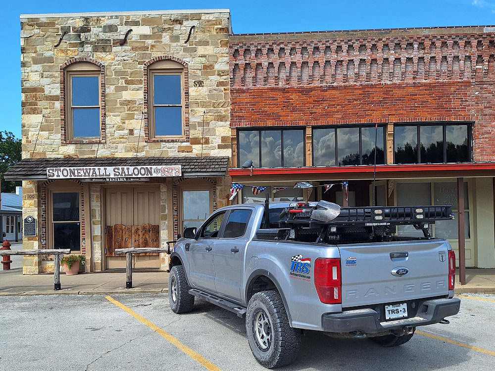
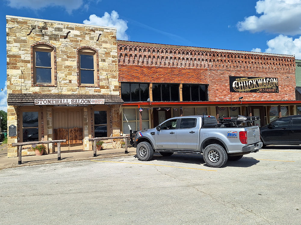
Saint Jo, Texas & The Stonewall Saloon
Established by primarily European Americans in 1856, the city was originally known as Head of Elm, named for its location at the headwaters of the Elm Fork of the Trinity River. Numerous settlers came to this area from the Upper South of Tennessee and Kentucky, attracted to new opportunities in Texas.
In 1873, the town was surveyed and its boundaries redefined. Joe Howell was a surveyor who originally laid out the town and is credited as its founder. Howell was said to have opposed alcoholic beverage sales and was given the nickname “Saint Jo.” Ironically, when Joseph Howell and Irb H. Boggess laid out the town, the Stonewall Saloon was built as a focal point. The building was the first permanent structure on the town square and was built to accommodate cowboys as they moved herds of Longhorns up the Chisholm Trail. It even had a boarding house upstairs.
Today, the saloon is a museum sharing the history of the Chisholm Trail.
Next to the Saloon is the Jesse Chisholm Chuckwagon Restaurant. The restaurant has good reviews, but I find it ironic that it’s named after a guy that died of food poisoning. I doubt the restaurant is cooking anything with bear grease, so you probably don’t have to worry. Yes, I get that they’re trying to connect with the history of the area and keep it alive. I’m not knocking it.
Check Out:
Jesse Chisholm Chuckwagon Restaurant
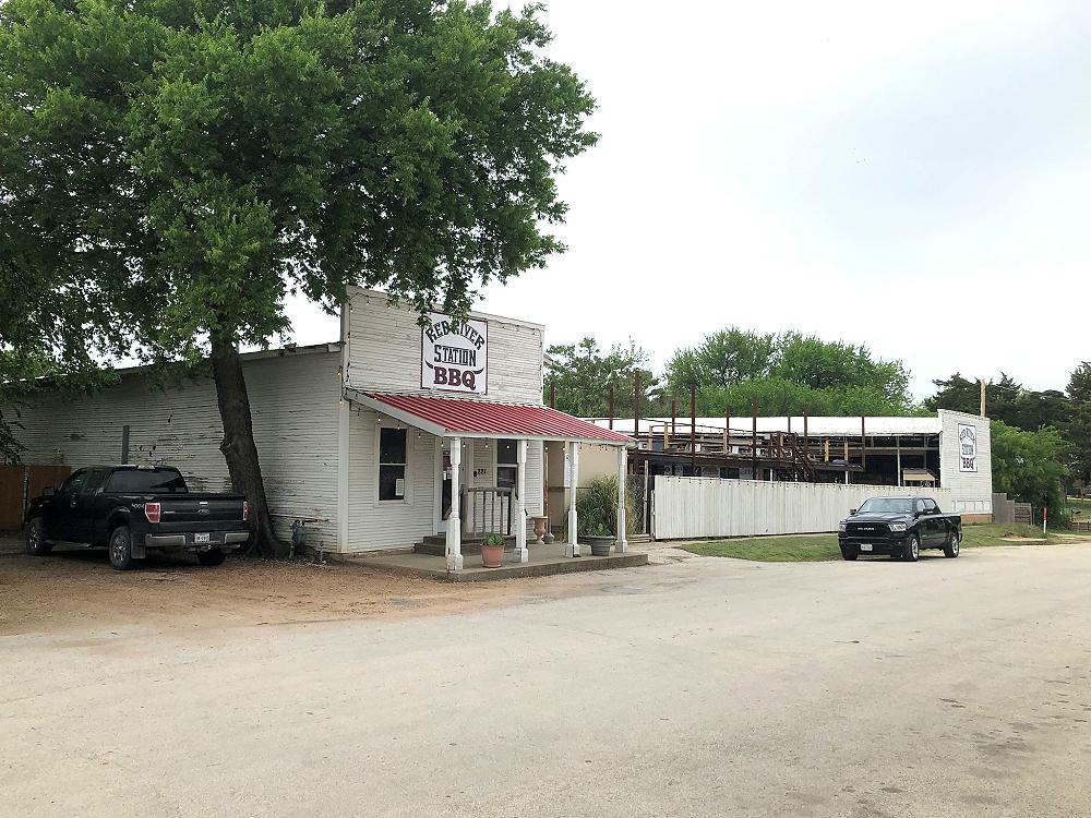
Red River Station (Saint Jo)
There is actually a place in Saint Jo called Red River Station and may be the first thing search engines bring up when you search ‘Red River Station’. It’s actually only open on Fridays and Saturdays as an outdoor concert venue and serves BBQ inside with a bar outside. I’ve actually been to a couple of concerts here and it’s my favorite concert venue.
See: Red River Station
Justin Boots – Nocona Boot Company
I want to touch back on the H.J. Justin story.
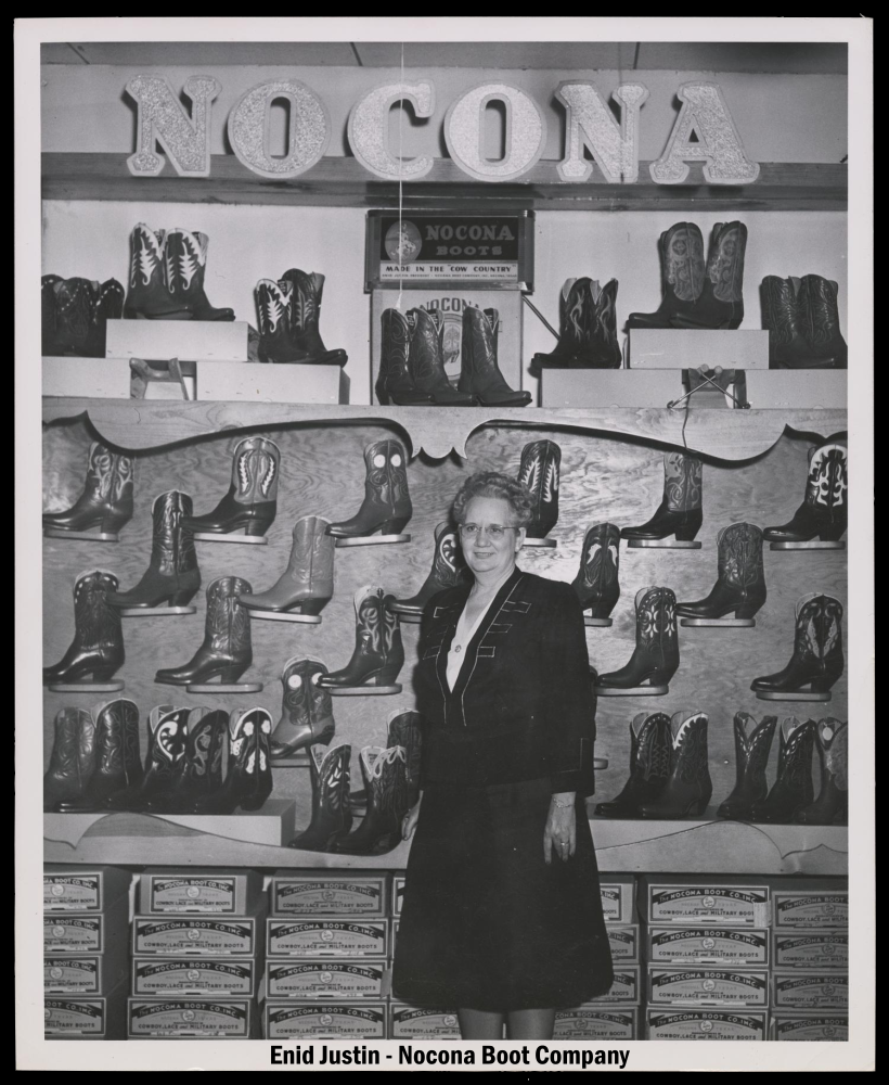
After the railroad came through Montague County and Nocona became a town, H.J. Justin moved his boot business there. After he passed in 1918, his three sons took over the business and moved the headquarters to Fort Worth. Enid (H.J. Justin’s daughter), thinking that her father would have wanted the company to stay in Nocona, created the Nocona Boot Company. Nocona Boots became popular, and business boomed so much that in June 1981 Justin Industries acquired all of the Nocona Boot Company’s outstanding stock. Enid Justin passed away in 1990, and in 1999, the Nocona plant was shut down and production was moved to El Paso, Texas.
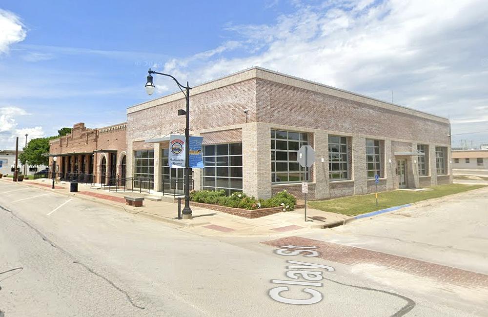
Today the old Justin boot factory in Nocona is now the H. J. Justin community center and city hall. Locally the community center is just referred to as ‘The Justin’. It wasn’t until I ended up on this little adventure and started doing research that I realized the history and importance of that building. For some reason I had never connected ‘Justin’ to Justin of Justin Boots.
Created in 1879 Justin Boots is the second oldest cowboy boot company in the United States.
H.J. Justin and Enid Justin are both buried in the Nocona, Texas Cemetery.
See: Justin Boots
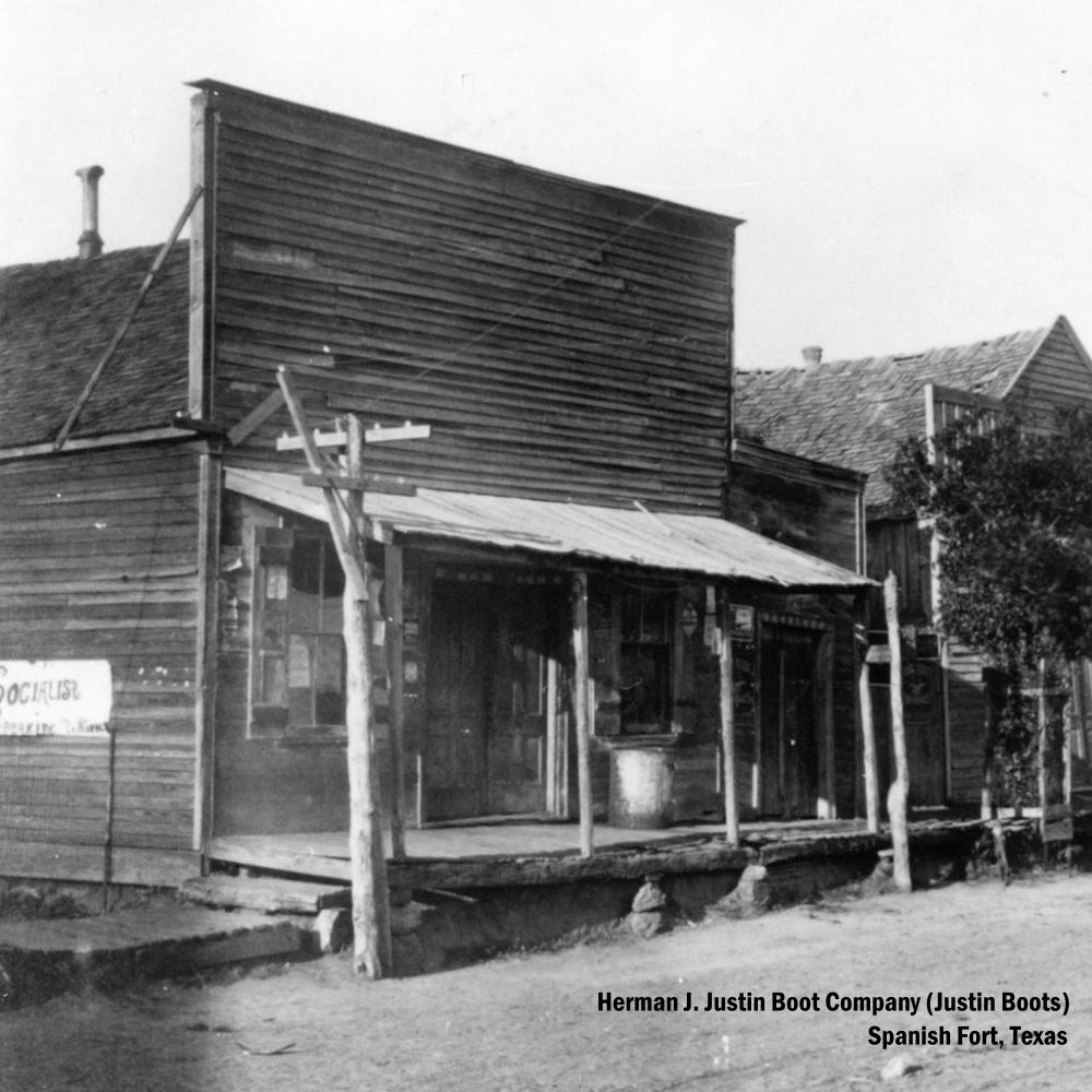
Above is the original Justin Boot Company in Spanish Fort, Texas.
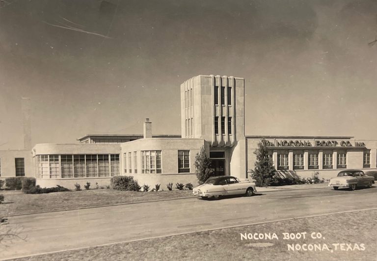
Below is the Justin boot factory in Nocona, Texas and then a look at the Justin community center and Nocona city hall.
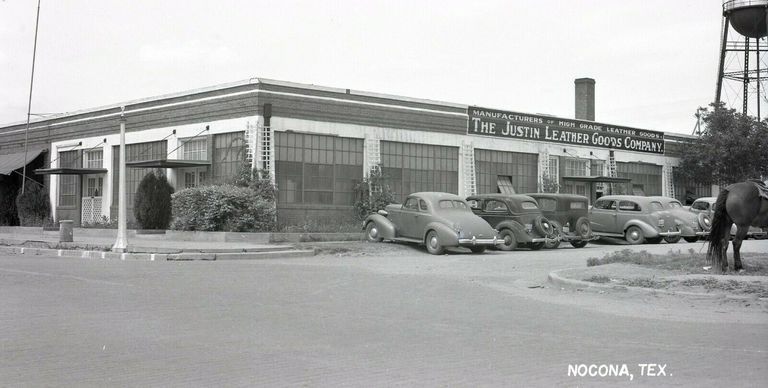
The old Nocona boot factory in Nocona, Texas is an interesting building that once employed hundreds of employees. It’s sad that Justin Boots bought it out and then relocated it to El Paso and abandoned the people of Nocona for a second time.
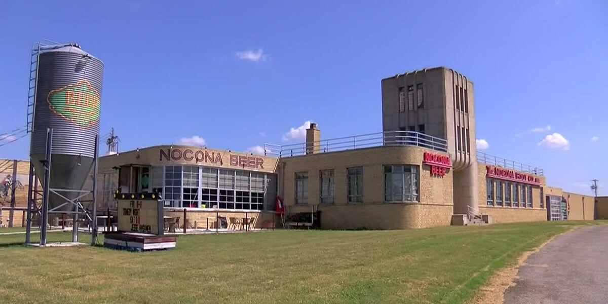
Today this beautiful building is the home of Nocona Beer & Brewery. They kept the ‘Nocona Boot Co’ neon sign on the front of the building and added a matching Nocona Beer sign. The building is also home to Nokona Leather Goods.
Nokona Leather Goods
As mentioned above, the old Nocona boot factory is home to Nokona Leather Goods.
I find it fascinating that Nokona Leather Goods is also in Nocona because as far as I know, they are the last baseball glove manufacturer to actually make baseball gloves here in the United States.
Established in 1926 as the Nocona Leather Goods company by the Storey family in Nocona, Texas. The company first began selling wallets, purses, and belts. Nocona Leather Goods entered the sporting goods industry in 1932. In 1934, The Nokona baseball glove was trademarked (spelled with a “k” when the United States Patent and Trademark Office would not allow the name of an incorporated town to be registered).
In 1942, Nokona received a government contract to produce baseball gloves for the United States Military during the War. Production soared to 1,000 gloves per day (up from 50 to 100), requiring the factory to expand.
During the 1960s, many sports manufacturers moved from the United States to Asia, where materials and labor are cheaper. However, Bob Storey would not move. He has reportedly said that he would rather quit and go fishing than closeup his factory and move.
In 1989, Hollywood ordered replica vintage Nokona baseball gloves for the movie ‘Field of Dreams’, and later in the film ‘A League of Their Own’.
In July 2006, the 80-year-old factory burned to the ground and the company relocated to the old Nocona boot factory.
Nokona reintroduced a line of leather goods in 2019, called Nokona Leather Goods, harkening back to the origin of the company in 1926. All products are handcrafted in the United States with Nokona’s ballglove leather, with a growing offering that includes wallets, totes, bags, footwear, belts, and outerwear.
Nokona is the glove of choice for some of the biggest names in professional baseball, including Todd Walker, Jorge Sosa, Jeff Fulchino, and MLB Hall of Fame legend Nolan Ryan. Today professionals like Cody Anderson, Scott Barlow, Steven Brault, Austin Brice, Blaine Hardy, Tim Mayza, Addison Reed, and many others take the field wearing a Nokona glove. Some pass on lucrative sponsorship deals with other manufacturers so they can keep using their Nokona glove of choice.
To my knowledge, Nokona are the only baseball gloves still made in the United States.
You can tour the factory on Mondays, Wednesdays & Fridays: 10:30 & 1:30.
See: Nokona Leather Goods
See: Nokona – Pro Players Featured Lineup
Fenoglio Boot Company
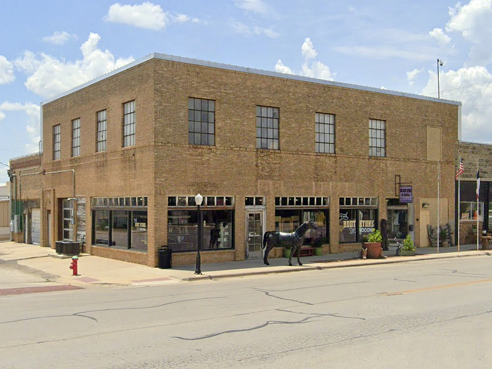
It’s worth mentioning that cowboy boots are still made in Nocona, Texas. When the Nocona Boot Company left Nocona, some of the former employees created the Montague Boot Company in 2001. The company was sold in 2014 to the Fenoglio family who turned the company into Fenoglio Boots and continue to make boots in Nocona. The Fenoglio Boots storefront downtown on Clay Street is actually located in the original Nocona Boot Company building opened by Enid Justin. The building is positioned across the street from the Justin Community Center which started out as the Justin boot factory.
It’s interesting that Justin Boots lead to the Nocona Boot Company, which lead to the Montague Boot Company, which lead to the Fenoglio Boot Company.
Fenoglio Boots employs 50-60 people and makes 200-250 pairs of boots a day in Nocona, Texas. Although the company was created in 2014, the business employs generations of boot makers that have been making cowboy boots here in Nocona from when the Nocona Boot Company was here.
See: Fenoglio Boots
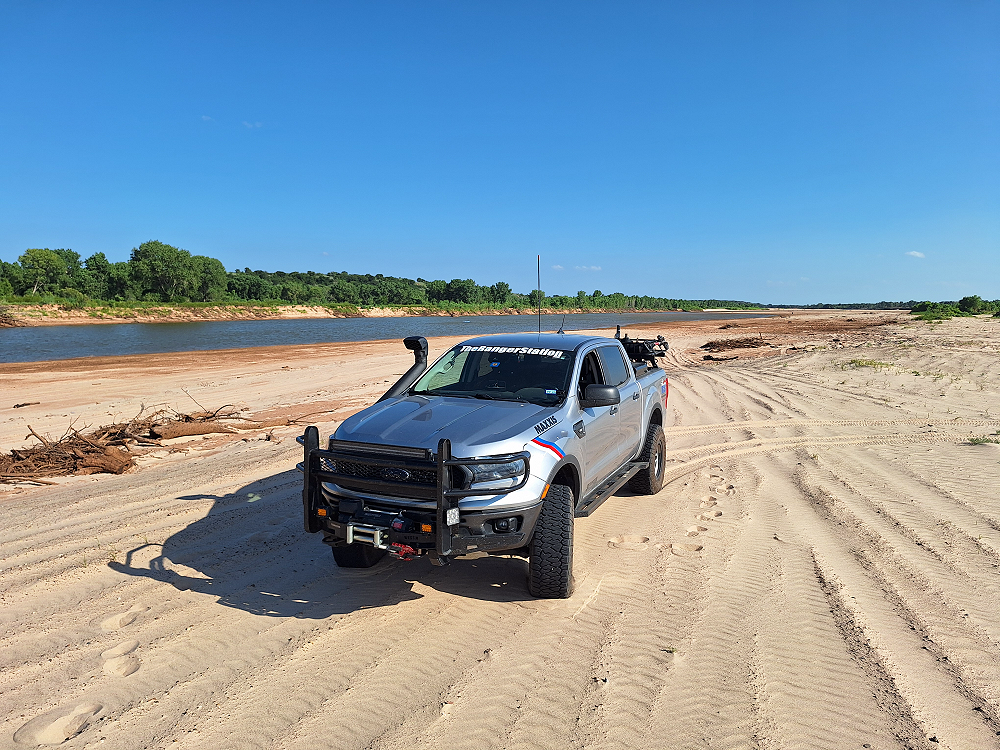
Getting Down Into The Red River
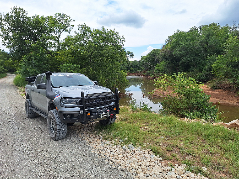
I think you need to get down into the Red River to really appreciate the river and get a better feel for what the cattle and drovers were crossing.
The best place to really experience the Red River is on Texas Route 79 where it crosses into Oklahoma. Just before you get to the Red River there’s an access road off to the right. As soon as you turn on that road there’s a trail to the left that runs next to the highway and takes you to the river.
The flooding left a lot of sand along the river, so be careful. My 3.5-inch Skyjacker suspension and Maxxis RAZR AT tires kept me on top of the sand and moving through it without any problems.
The best thing about this area is it’s legal to drive here. This river access is west of Waurika, Oklahoma and is about a 30-minute drive from Ringgold, Texas (US 81).
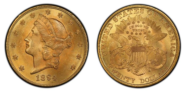
The Red River Treasure
In 1894, four men robbed the First National Bank in Bowie, Texas and got away with $18,000 cash and $10,000 in $20 gold pieces. The outlaws headed north and stopped to rest on the bank of the Red River. Meanwhile, Deputy U.S. Marshal Lewis Palmore, who was located north in Indian territory, received a telegram that the outlaws were headed his way.
Knowing that the outlaws would have to cross the flooded Red River at Rock Crossing, Deputy Marshal Palmore arranged for a posse to be waiting the next morning. When the outlaws departed their camp, they spotted a posse approaching from the south and plunged into the river swimming beside their horses. Little did they know that they were swimming into the hands of another posse waiting on the other side of the river. Palmore arrested the four men and found $18,000 in their saddle bags but the $10,000 in $20 gold pieces wasn’t there.
The outlaws were taken to Fort Smith, Arkansas and sentenced to hang. Palmore was there for the execution, and one of the outlaw’s awaiting execution told Palmore that they had hidden the gold coins near their camp by the Red River. When Palmore returned to the area, he searched for the coins but never found them. The coins are said to be buried somewhere between the bridge on US Highway 81 and the mouth of the Little Wichita River about 3.5-miles to the west.
Today those gold coins would be worth around $21,602,551. Yes, that’s $21.6 million.
Resources:
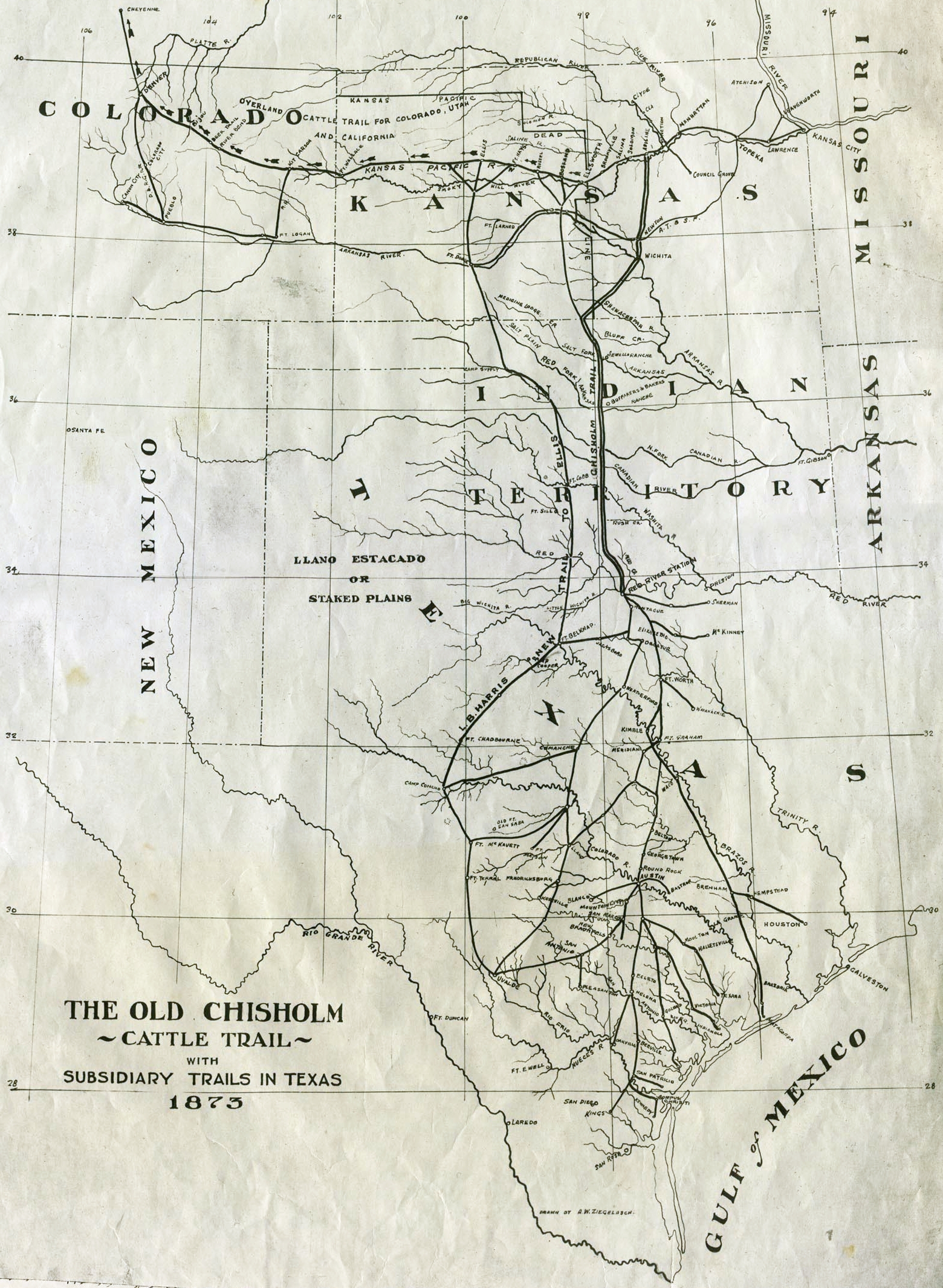
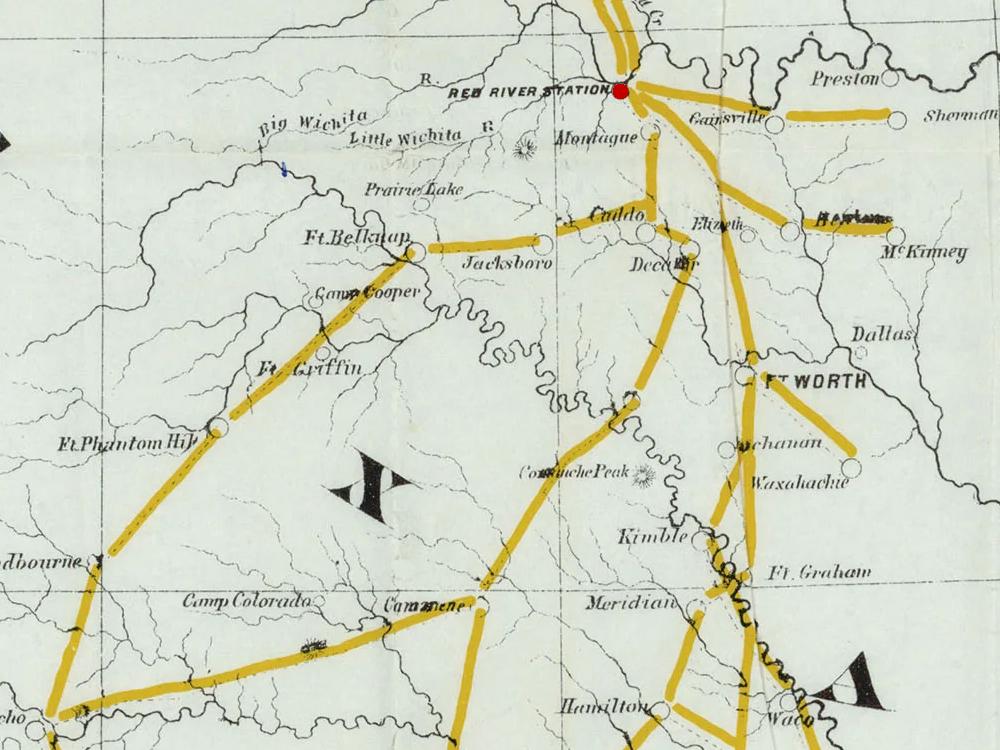
The Chisholm Trail Route & Its Demise
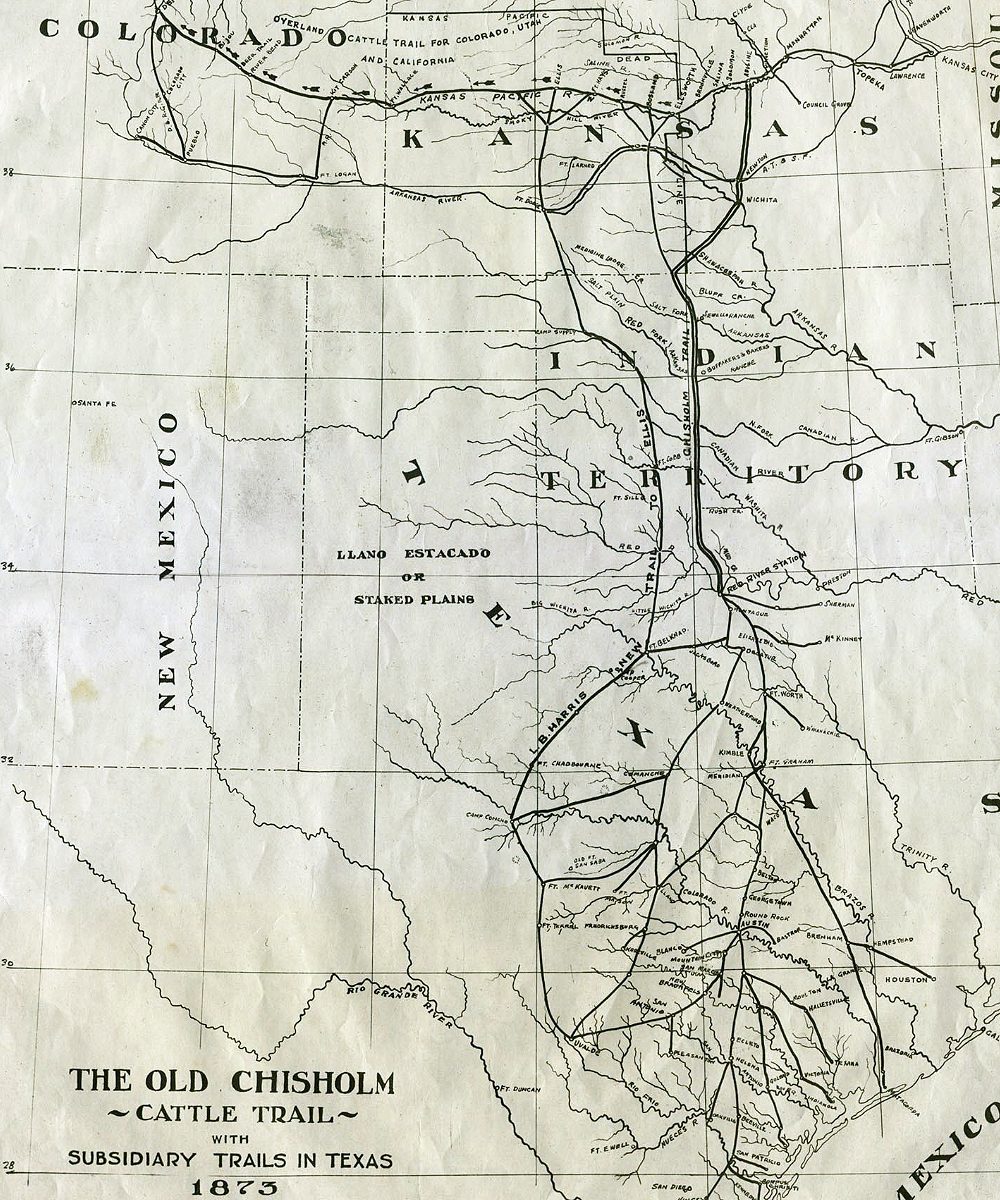
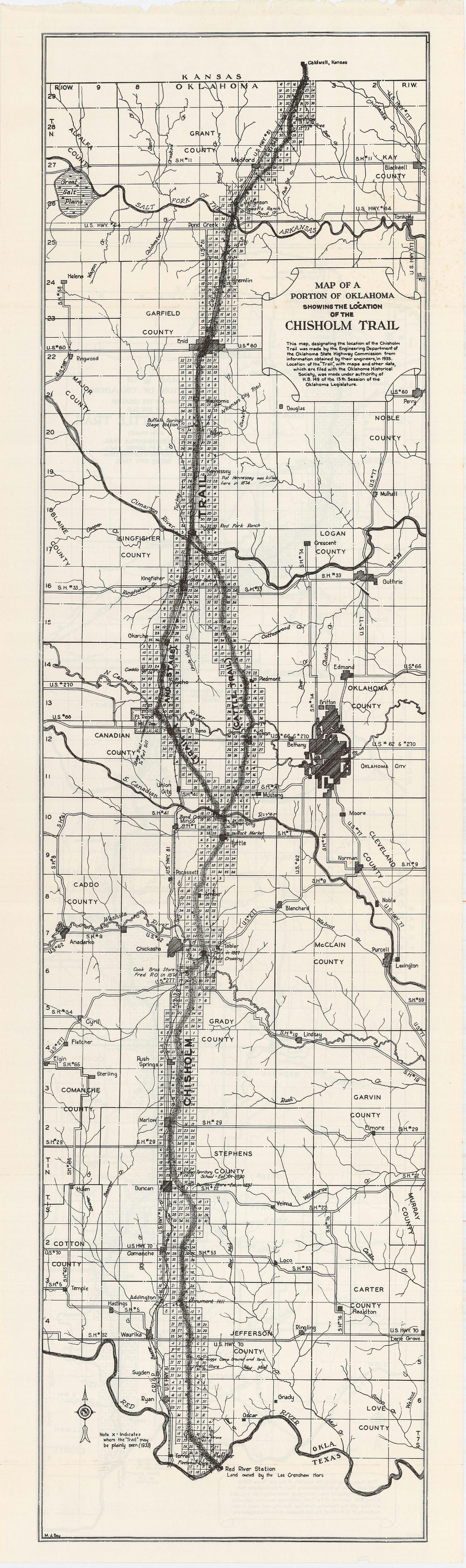
The Chisholm Trail crossed from Texas over into Indian Territory at Red River Station, heading north. Along the way it passed Fleetwood Store, Blue Grove, Reid Store, Old Suggs Camp Ground and Tank, Monument Hill, Old Duncan Store, Cook Brothers Store, and Silver City on the South Canadian River. North of Silver City, the trail divided. The western route, primarily for freight and stages, curved slightly northwestward, ran through Concho, Fort Reno, and Kingfisher Stage Station, and then turned northeast. The eastern branch, used primarily for cattle, left Silver City, curved slightly northeastward, passed west of present Mustang, crossed through Yukon, and passed to the west of Piedmont, crossing the Cimarron where Kingfisher Creek joins that river. The eastern trail rejoined the western trail at Red Fork Ranch, or Dover Stage Stand, now the town of Dover. North of Dover the trail passed by Buffalo Springs Stage Station (near present Bison), Skeleton Ranch (near Enid), Sewell’s Ranch (near Jefferson), and Lone Tree (near Renfrow), before heading into Kansas south of Caldwell.
In 1884, Texas cattle faced significant challenges due to quarantine laws imposed by northern states to prevent the spread of Texas fever, a tick-borne disease. Northern cattlemen, fearing economic losses from Texas cattle, lobbied for quarantine measures, leading to the passage of laws that restricted cattle drives from Texas to the north.
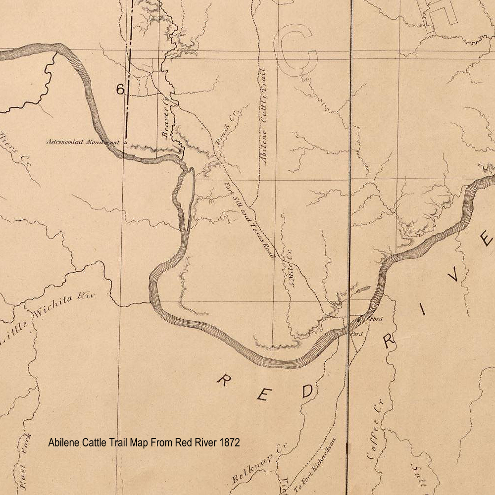
The map below from 1872 shows that the trail north of Red River was called the Abilene Cattle Trail. You can see on the map where the trail separated and came back together as mentioned earlier.
Resources:
Chisholm Trail – Oklahoma Historical Society
Conclusion & Observations
If find it bizarre that there are so many things in Texas named after the Chisholm Trail, but the cattle trails in Texas were just un-named feeder trails that led to Red River Station. When you left Red River Station, you were on the Abilene Trail. The name Chisholm Trail was adopted after it was no longer in use.
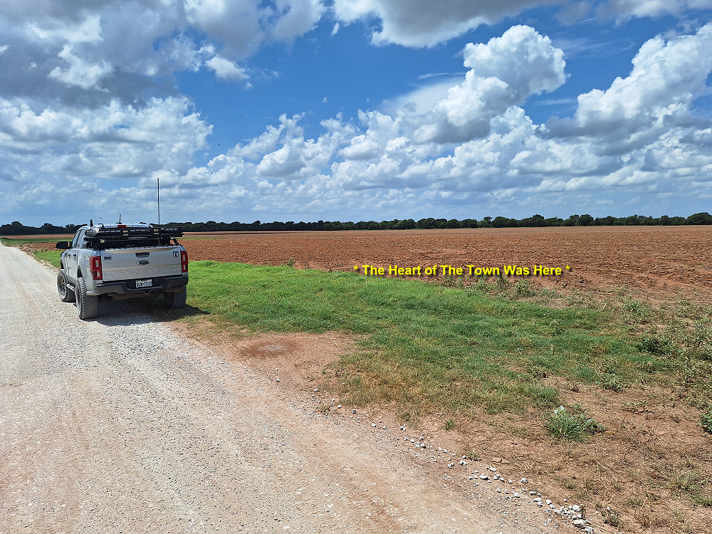
I see all of this emphasis on the trail, and several cities in Texas have bronze statues and murals on buildings dedicated to the trail and trying to connect themselves to it, but the real emphasis should be Red River Station. After all, that’s where all the cattle were headed to. Today, Red River Station is just an empty field with a monument along a tree line. There’s no monument by the road. There isn’t even one of those Historical Marker Ahead signs that you see all over Texas.
The city of Nocona is only 7-miles away and pretty much replaced Red River Station after the railroad came through. Nocona has a Tails ‘N’ Trails Museum, and a rodeo arena named Chisholm Trail Arena, But no bronze statues or murals. Saint Jo has a nice mural, but Saint Jo was actively involved in the cattle drive when it was happening. I feel like there should be something in Nocona that celebrates that this is where all of those cattle were going to so they could cross the Red River on their way to Kansas.
Observations:
- For much of its time during the cattle drives, Red River Station was actually named ‘Salt Creek’.
- The cattle trail north from Red River Station was called the Abilene Trail. It was called ‘Chisholm Trail’ in later years.
- The actual Chisholm’s Trail was a wagon road in Oklahoma from Wichita Agency to Wichita, Kansas.
- An estimated 10-million Longhorn cattle travelled from Texas to Kansas with an estimate value of $400 million ($8.68 billion today)
- Justin Boots was started in Spanish Fort, and then located in Nocona, Texas until H.J. Justins death.
- Nocona Boots was created by H.J Justins daughter (I actually knew this) and remained in Nocona until after Enid’s death.
- H.J. Justin and Enid Justin are both buried in the Nocona Cemetery.
- Nokona Leather Goods was started in Nocona in 1926 and is the only company that still makes baseball gloves in the USA.
- The Fenoglio Boot Company was made up from employees of the old Nocona Boot Company factory.
- There’s $21 Million dollars of lost $20 gold coins around here somewhere.
Where To Next
I really got caught up in the history of the Chisholm Trail and other cattle trails while researching this information. Now that I pretty much know the path that the Chisholm Trail took, I’m tempted to find the closest gravel roads (and there’s a lot of them in Oklahoma and Kansas) and retrace its path from the other side of the Red River north to Abilene, Kansas.
You Can Do This Adventure
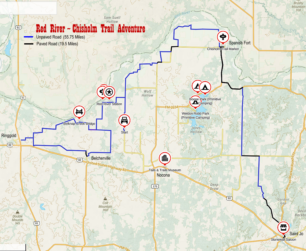
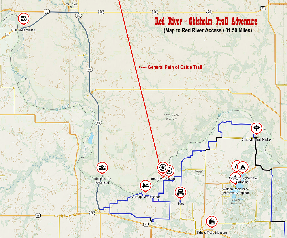
This would be a nice North Texas weekend adventure. Below is a map of my travels. I did not include the roads that deadened. I included the GPS files below the maps if anyone wants to take this same adventure. The total trip is 81.25 miles. 75.25 miles if you don’t go up US Highway 81 to the Red River. Of those miles 55.75 of them are off pavement. I’d give yourself 4-hours to drive it, stop and see the sights, and just enjoy the view of the area. It’s another 31.50-miles to the Red River access on State Highway 79. I highly recommend it. It’s worth the drive.
Don’t forget me if you find the missing gold treasure.
To really enhance your experience, you can check out the Tails ‘N’ Trails Museum in Nocona, and the Stonewall Saloon Museum in Saint Jo.
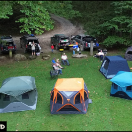
Camping
There are three different parks around Lake Nocona that offer primitive camping. No bathrooms. There’s also the 4R Ranch Top-O-Ridge campground which is also a winery.
Food Recommendations:
- The Grazing Grove – Saint Jo
- The Windmill Grill – Saint Jo
- Jesse Chisholm’s Chuckwagon – Saint Jo
- Red River Pizza – Nocona
- Nocona Beer & Brewery – Nocona
Red River ~ Chisholm Trail Adventure Maps:
Map View
Map Download
Map of my Route:
Map showing how to get down into the river on State Highway 79:
Explorer Bear Fridge
I almost forgot, the Explorer Bear 40L refrigerator works great!! I have since built a slider to secure it to. Look for more on that in the future.
Check out: Explorer Bear 12 Volt Refrigerator
Adventure Video
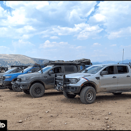
Miscellaneous Photos
About The Author
Jim Oaks is the founder of TheRangerStation.com, the longest-running Ford Ranger resource online since 1999. With over 25 years of hands-on experience building and modifying Ford Rangers — including magazine-featured builds like Project Transformer — Jim has become one of the most trusted authorities in the Ford Ranger off-road and enthusiast space.
Since launching TheRangerStation.com, Jim has documented thousands of real-world Ranger builds, technical repairs, drivetrain swaps, suspension modifications, and off-road adventures contributed by owners worldwide. TheRangerStation.com has been referenced in print, video and online by enthusiasts, mechanics, and off-road builders looking for practical, and experience-based information.