Day #12 - Thursday June 13th, 2019:
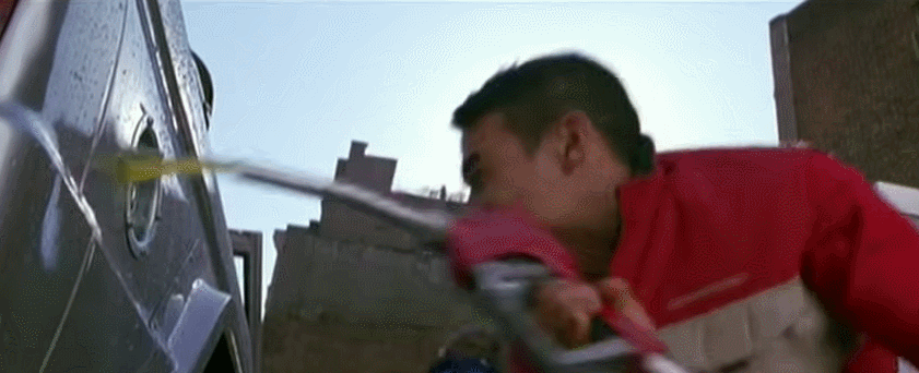
I started my day out by filling the Ranger up with gas. I briefly forgot it was a crime to pump your own gas in Oregon. They recently changed the law though so that some rural areas can allow you to pump your own gas, but they apparently don't trust their citizens to pup gas in larger areas for fear they'll wipe out a whole city.
(How Oregon thinks I pump my gas)
More miles = more cows.
A brief standoff with a fat cow, but I sent her hoofing it.
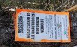
I came across another gate today where you turn from Rose Creek Rd to NF-16. This time it was built like a section of wire fence. the gate was looped with wire pretty tightly at the top and bottom, and then it had wire wrapped around a big stick that kept tension on the gate more towards the middle. I wasn't confident that if I got the gate open I would actually be able to close it myself.
Ranchers will typically have a cattle grate in the road to keep their cattle in. I encountered one gate that you could actually open and close like a normal gate. These are public lands, and the ranchers can't close the road to the public. They can put up a gate to keep their cattle in, but you should be able to open and close it behind you.
It started to rain, so I decide to detour and not mess with the gate. A little further down the road, and it looked like the road became someones driveway. The road seemed to disappear behind their house, and didn't look very promising. I stopped and talked to the property owner for a while. I explained what I was doing, and the problem I had with the gate. It wasn't his gate, but he told me I had a legal right to use the road, and gave me some instructions on how to get the gate open. He suggested that some ranchers may try to keep people out of the area when they put up gates, and I believe the rancher in question chose to build this style gate to look like a fence, and try to deter people from going past it.
I would suggest that anyone doing the TAT bypass this spot so they don't have to deal with this gate.
If you turn right on US 26 instead of crossing on to Rose Creek Road (In Ironside), you can travel about 8.5-miles and connect with E. Camp Creek Road (NFD-1684). It's the blue line on my map. The red line is the TAT route. E. Camp Road (NFD-1684) turns in to NFD-1680, and eventually NF-16 and the TAT. If you follow the TAT on Rose Creek Road, be prepared to open the gate.
Looking back, I really wish I would have opened the gate, and it annoys me that I let a rancher deter me from using a National Forest Road.
I actually talked with the rancher for a little while. He told me he had 20,000 acres of land, and around 1,000 head of cattle. The land apparently belonged to his grandfather, and his grandfather had a homestead where we were now. He told me that the road going up behind his house ended and wasn't passable. He then told me about a turnoff a short distance back for a private road, and told me I could use it.
That road had beautiful views, and was in amazing condition, although I'm sure only a few people know about it and use it.
Along the way I met a guy on an ATV that stopped to see if I was OK. I explained the situation, and that the first guy gave me permission to use the road. He was really nice and helpful, and gave me some brief directions on where to turn so I ended up back on the highway.
A couple miles later, and I came across his grandfather in a pickup, who was just as nice as the first two guys. We spoke for a few minutes before I continued on my way. I don't remember how many miles he said this road was (it's pretty long..), but he said they built it in a week with a large bulldozer, and a couple of dump trucks.
This private road eventually linked back up with a public road, and brought me out by Beulah Reservoir. From there the road goes to US 20, and I had to head west, and then north on US 395 to reconnect with the Trans America Trail. This took me way out of my way, and made me really annoyed at the rancher that had put the fencing up over the road. Looking back, I should have opened it, and simply closed it as best I could.
Linking back up with the TAT took me back in to the Malheur National Forest west of US 395. In some areas, the roads were wide with smooth gravel. Other sections were rough. At one point, I wasn't sure if the trail I was on would even make it all the way through.
I will warn you that these sections through the National Forests in Oregon are longer and more difficult than you may anticipate.
Travelling west takes you in to the neighboring Ochoco National Forest. The sun was starting to set on me, so I ended up heading south off of the TAT on to CR 380, and taking that in to Prineville. After grabbing some Taco Bell before the lobby closed, I headed west to Redmond and spent the night in a hotel. My original plan had been to camp in the Redmond area, but the detour and lengthy sections of the National Forest caused me to get there much later than I had planned.
UPDATE: Here's a video highlight of the days trip:
Total miles driven off pavement today:
205 miles.